Approximate Location Map
Large Map »
Latitude: 55.953 / 55°57'10"N
Longitude: -3.1135 / 3°6'48"W
OS Eastings: 330564
OS Northings: 673888
OS Grid: NT305738
Mapcode National: GBR 2C.XVX4
Mapcode Global: WH6SN.4MMQ
Plus Code: 9C7RXV3P+5H
Entry Name: 5 Bath Street, Portobello, Edinburgh
Listing Name: 5 and 7 Bath Street
Listing Date: 4 September 1995
Category: C
Source: Historic Scotland
Source ID: 363452
Historic Scotland Designation Reference: LB26728
Building Class: Cultural
ID on this website: 200363452
Location: Edinburgh
County: Edinburgh
Town: Edinburgh
Electoral Ward: Portobello/Craigmillar
Traditional County: Midlothian
Tagged with: Building
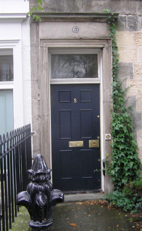
Early 19th century, with later additions and alterations (later additions to rear). 2-storey, 4-bay pair of terraced houses with shop front to W corner, ground, No 5. Finely droved ashlar, polished ashlar doorpieces and dressings, wooden canted window to No 7; harled SW elevation; painted and harled to rear, harled extension. Base course, cill course to 1st floor, mutuled cornice, blocking course; band course to canted window.
NW (PRINCIPAL) ELEVATION: modern panelled doors grouped closely at centre, rectangular plate glass fanlights above, moulded architrave doorpiece with cornice; windows at 1st floor. Window to 1st floor of bay to right, shop front to ground; full-height canted window in bay to left. Shop front with dentilled cornice and clasping corner pilaster.
SE (REAR) ELEVATION: 2-storey extension to centre bays.
Plate glass timber sash and case windows. Cast-iron window guards still in place to No 5. Grey slate roof, now modern at No 7. Harled gable end stack at No 5; rendered mutual stack to left.
INTERIORS: not seen, 1994.
The lisitng includes No 5A Bath Street. These are part of a broader terrace, dating from before 1824. The extension to the rear dates from before 1856. Wood's map, 1824 does not show the division of the properties.
External links are from the relevant listing authority and, where applicable, Wikidata. Wikidata IDs may be related buildings as well as this specific building. If you want to add or update a link, you will need to do so by editing the Wikidata entry.


Other nearby listed buildings
