Approximate Location Map
Large Map »
Latitude: 57.2845 / 57°17'4"N
Longitude: -2.3735 / 2°22'24"W
OS Eastings: 377583
OS Northings: 821607
OS Grid: NJ775216
Mapcode National: GBR X8.VP5N
Mapcode Global: WH8NW.H5ZF
Plus Code: 9C9V7JMG+RJ
Entry Name: Northburn, Port Road, Inverurie
Listing Name: Northburn, Port Road
Listing Date: 11 September 1984
Category: C
Source: Historic Scotland
Source ID: 379982
Historic Scotland Designation Reference: LB35401
Building Class: Cultural
ID on this website: 200379982
Location: Inverurie
County: Aberdeenshire
Town: Inverurie
Electoral Ward: Inverurie and District
Traditional County: Aberdeenshire
Tagged with: House
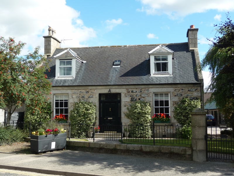
Circa 1880. Single-storey 2-window and centre fanlight
tripartite doorpiece, harled with margins, eaves belt
course; original glazing; 2 piended dormers, later or
reglazed. Circular granite gatepiers.
External links are from the relevant listing authority and, where applicable, Wikidata. Wikidata IDs may be related buildings as well as this specific building. If you want to add or update a link, you will need to do so by editing the Wikidata entry.


Other nearby listed buildings
