Latitude: 53.2723 / 53°16'20"N
Longitude: -3.2188 / 3°13'7"W
OS Eastings: 318816
OS Northings: 375723
OS Grid: SJ188757
Mapcode National: GBR 5ZYL.YP
Mapcode Global: WH76R.J0GR
Plus Code: 9C5R7QCJ+WF
Entry Name: Masonic Hall
Listing Date: 19 August 1991
Last Amended: 19 August 1991
Grade: II
Source: Cadw
Source ID: 418
Building Class: Institutional
ID on this website: 300000418
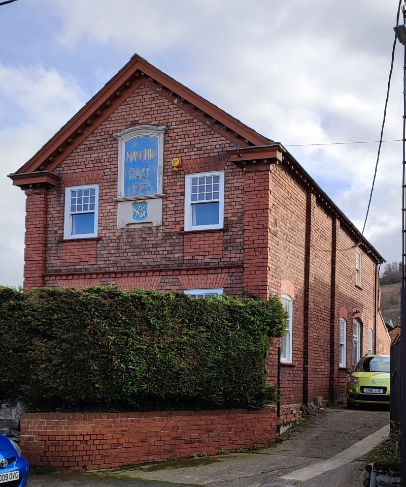
Location: Long building at right angles to the road and to left of Nos 10 and 12; set back behind walled forecourt.
County: Flintshire
Community: Holywell (Treffynnon)
Community: Holywell
Built-Up Area: Holywell
Traditional County: Flintshire
Tagged with: Architectural structure
Dated 1915; probably by the same architect as the similar Territorial Army Drill Hall, which is immediately to the rear. Simple 'Queen Anne' detail and treatment of brickwork; style of F A Roberts, architect of Mold.
2-storey red brick structure with slate roof, overhanging eaves and red brick chimney stack at the back; paler gauged brick dressings. 2-window gable end front gives architectural unity with Nos 10 and 12 and the English Congregational Church. Open pediment treatment with bracket cornice, channelled end pilasters; dentilled band at ground floor lintel level, voussoirs and deep 1st floor aprons. Small-pane glazing to horned upper sashes. Central, dated 'Masonic Hall' plague. Camber headed openings to side elevations, the first two bays of which are marked by advanced pilasters; panelled door to right. Similar glazing to rear. Interior not seen.
Included for group value with neighbouring listed items on Coleshill Street (SW side) and the Territorial Army Drill Hall on Halkyn Street (NE side).
External links are from the relevant listing authority and, where applicable, Wikidata. Wikidata IDs may be related buildings as well as this specific building. If you want to add or update a link, you will need to do so by editing the Wikidata entry.


Other nearby listed buildings