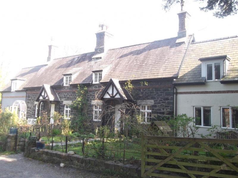
Church Cottages
A Grade II Listed Building in Llanfairfechan, Conwy
Coordinates
Latitude: 53.2532 / 53°15'11"N
Longitude: -3.978 / 3°58'40"W
OS Eastings: 268132
OS Northings: 374731
OS Grid: SH681747
Mapcode National: GBR 0ZNT.KK
Mapcode Global: WH543.VHWD
Plus Code: 9C5R723C+7Q
Entry Name: Church Cottages
Listing Date: 14 April 1992
Grade: II
Source: Cadw
Source ID: 3514
Building Class: Domestic
ID on this website: 300003514
Location: In churchyard of Christ Church, to N of Church.
County: Conwy
Community: Llanfairfechan
Community: Llanfairfechan
Built-Up Area: Llanfairfechan
Traditional County: Caernarfonshire
Tagged with:
Cottage
History
Pair of Cottages c1860's (shown on Bryn-y-Neuadd Estate sale map of 1876).
Reasons for Listing
Group value with Christ Church.
External Links
External links are from the relevant listing authority and, where applicable, Wikidata.
Wikidata IDs may be related buildings as well as this specific building. If you want to add or update a link, you
will need to do so by editing the Wikidata entry.
Recommended Books
Other nearby listed buildings
-
II
Church Cottages
In churchyard of Christ Church, to N of Church.
-
II
War Memorial
At roadside to N of entrance driveway to Christ Church.
-
II
Christ Church
To SW of road junction of Aber Road and Village Road.
-
II
Plas Llanfair Cottage
On W corner of Village Road and Parc Henblas.
-
II
Plas Newydd
Prominently sited at Junction of Village Road and Park Road, behind small walled garden.
-
II
Dutch Barn at Bryn-y-Neuadd Farm
Farm is at E end of grounds of Bryn-y-Neuadd Hospital, reached from Aber Road by driveway almost opposite War Memorial (SH 680 747). Barn is outside NE corner of Farm courtyard.
-
II*
Bryn-y-Neuadd Farmhouse, including attached dairy
At E end of grounds of Bryn-y-Neuadd Hospital, reached from Aber Road by driveway almost opposite War Memorial (SH 680 747). At SW corner of farmyard.
-
II
Northcot
At the junction of Park Road and The Close.