Approximate Location Map
Large Map »
Latitude: 53.0952 / 53°5'42"N
Longitude: -4.1878 / 4°11'16"W
OS Eastings: 253600
OS Northings: 357570
OS Grid: SH536575
Mapcode National: GBR 5M.935L
Mapcode Global: WH54S.NG0H
Plus Code: 9C5Q3RW6+3V
Entry Name: Betws Inn
Listing Date: 9 May 1990
Last Amended: 29 January 1999
Grade: II
Source: Cadw
Source ID: 4160
Building Class: Domestic
ID on this website: 300004160
Location: Set at a slight angle to the main road ( A 4085) immediately to the south of the Church of St Garmon.
County: Gwynedd
Town: Caernarfon
Community: Betws Garmon
Community: Betws Garmon
Traditional County: Caernarfonshire
Tagged with: Inn
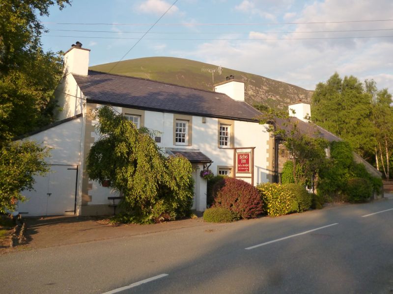
House, formerly an inn. Datestone "1750" is probably a reliable indication of the building's origins, although much appears to have been done in the early C19, including the addition of the range to the right; considerable renewal of detail in late C20.
Rubblestone, rendered to left with painted quoins and window surrounds, roughly coursed to right; slate roofs. 2 storeys over basement. Left part has 3-window front; recessed late C20 12-pane glazing bar sashes with slate cills; central lean-to porch and rebuilt integral end stacks. Datestone between left and centre first-floor windows reads " Pierce 1750". Lower extension to right has two 9-pane sashes (again late C20) below eaves and central half-glazed door; rebuilt integral end stack to right. Lean-to attached to gable end has milestone to front wall inscribed "TO CARNARVON/ 5M/ BEDDGELERT 8". Extended and flattened roof pitch to 3-window rear range with original 30-pane sash window.
Not accessible at time of Survey.
Listed as a building of C18 origins retaining late Georgian character despite extensive repair in the late C20. Its scale and siting indicate its earlier role as a road-side inn.
External links are from the relevant listing authority and, where applicable, Wikidata. Wikidata IDs may be related buildings as well as this specific building. If you want to add or update a link, you will need to do so by editing the Wikidata entry.


Other nearby listed buildings
