Approximate Location Map
Large Map »
Latitude: 52.8044 / 52°48'15"N
Longitude: -4.7122 / 4°42'43"W
OS Eastings: 217274
OS Northings: 326432
OS Grid: SH172264
Mapcode National: GBR GPR8.SC8
Mapcode Global: WH33M.LRBY
Plus Code: 9C4QR73Q+Q4
Entry Name: Pont Fawr
Listing Date: 19 October 1971
Last Amended: 26 June 1998
Grade: II
Source: Cadw
Source ID: 4227
Building Class: Transport
ID on this website: 300004227
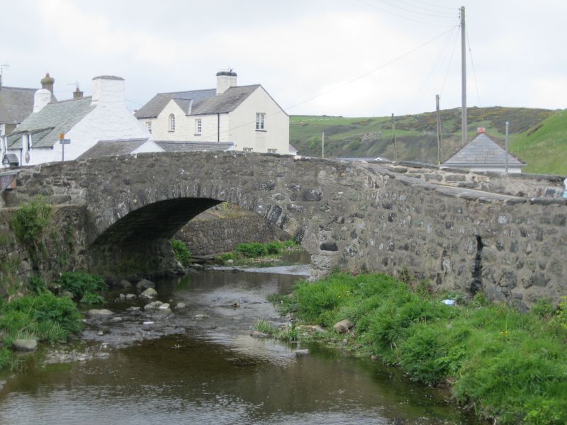
Location: Situated in centre of Aberdaron.
County: Gwynedd
Town: Pwllheli
Community: Aberdaron
Community: Aberdaron
Traditional County: Caernarfonshire
Tagged with: Bridge Road bridge
Single-arched road bridge over the Daron, probably earlier C19.
Single-arched road bridge of rubble stone, with broad shallow arch, stone flush voussoirs and rubble parapets with slab capstones. Parapets extend out, curving to line of road, rounded pier at NW end. NE parapet continuous with parapet of Pont Fach (q.v.).
An attractive road bridge of group value with Pont Fach, the two bridges forming a focal point in the village.
External links are from the relevant listing authority and, where applicable, Wikidata. Wikidata IDs may be related buildings as well as this specific building. If you want to add or update a link, you will need to do so by editing the Wikidata entry.


Other nearby listed buildings
