Latitude: 51.6527 / 51°39'9"N
Longitude: -4.9579 / 4°57'28"W
OS Eastings: 195483
OS Northings: 199027
OS Grid: SR954990
Mapcode National: GBR G7.YVKB
Mapcode Global: VH1S6.0QTC
Plus Code: 9C3QM23R+3R
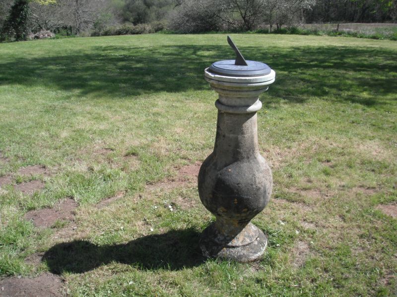
Entry Name: Sundial in front garden to E of Orielton Field Centre
Listing Date: 14 May 1970
Last Amended: 29 September 1993
Grade: II
Source: Cadw
Source ID: 6574
Building Class: Gardens, Parks and Urban Spaces
ID on this website: 300006574
Location: Situated on front lawn, E of mansion.
County: Pembrokeshire
Community: Hundleton
Community: Hundleton
Traditional County: Pembrokeshire
Tagged with: Sundial
Uncertain date, possibly C18.
Bath stone, large baluster shaft with dial replaced since 1970.
Group value with former Orielton mansion and other listed items in the grounds.
External links are from the relevant listing authority and, where applicable, Wikidata. Wikidata IDs may be related buildings as well as this specific building. If you want to add or update a link, you will need to do so by editing the Wikidata entry.


Other nearby listed buildings