Approximate Location Map
Large Map »
Latitude: 51.9397 / 51°56'23"N
Longitude: -3.3554 / 3°21'19"W
OS Eastings: 306919
OS Northings: 227671
OS Grid: SO069276
Mapcode National: GBR YQ.MY2D
Mapcode Global: VH6BZ.SHGV
Plus Code: 9C3RWJQV+VR
Entry Name: Canal Bridge on S side of A40
Listing Date: 16 December 1976
Last Amended: 4 November 2005
Grade: II
Source: Cadw
Source ID: 6806
Building Class: Transport
ID on this website: 300006806
Location: On S side of A40, about 250 metres S of Brynich Farm, and 200 metres E of roundabout.
County: Powys
Town: Brecon
Community: Brecon (Aberhonddu)
Community: Brecon
Traditional County: Brecknockshire
Tagged with: Bridge Road bridge
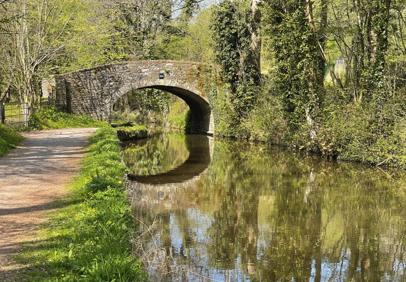
The Brecon - Abergavenny Canal was first cut in 1796 and reached Brecon in 1800.
Bridge of stone rubble with semi-elliptical arch with towpath beneath southern side of arch; parapet with coping rises on both sides towards centre of bridge. Bridge numbered 164.
Well-preserved late C19 canal bridge illustrating transport history.
External links are from the relevant listing authority and, where applicable, Wikidata. Wikidata IDs may be related buildings as well as this specific building. If you want to add or update a link, you will need to do so by editing the Wikidata entry.


Other nearby listed buildings
