Approximate Location Map
Large Map »
Latitude: 52.2741 / 52°16'26"N
Longitude: -3.0052 / 3°0'18"W
OS Eastings: 331510
OS Northings: 264471
OS Grid: SO315644
Mapcode National: GBR B6.YSXW
Mapcode Global: VH772.V3MH
Plus Code: 9C4R7XFV+JW
Entry Name: Formerly The Old Oak PH
Listing Date: 26 March 1985
Last Amended: 26 March 1985
Grade: II
Source: Cadw
Source ID: 8822
Building Class: Domestic
ID on this website: 300008822
Location: 13 Broad Street
County: Powys
Community: Presteigne (Llanandras)
Community: Presteigne
Built-Up Area: Presteigne
Traditional County: Radnorshire
Tagged with: Building
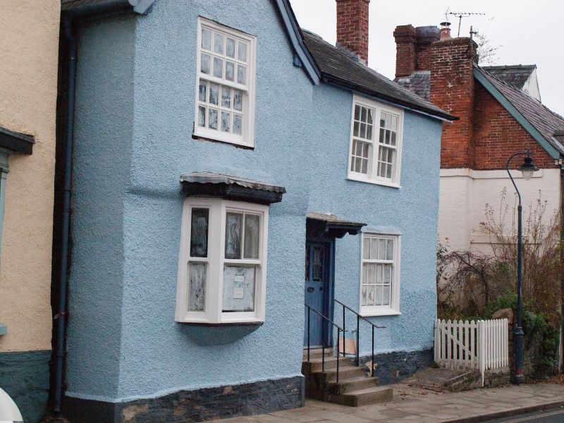
Later C16/ early C17, altered since.
2 storey L-plan roughcast front with cross wing (formerly jettied) on left. Slate roofs with higher range to rear. 1 window to cross wing, pair sashes to right, glazing bars, small ground floor bay added to left. Centre door under hood on curved brackets, railed steps up. 1st floor studding over rubble ground floor to left gable end.
Group value.
External links are from the relevant listing authority and, where applicable, Wikidata. Wikidata IDs may be related buildings as well as this specific building. If you want to add or update a link, you will need to do so by editing the Wikidata entry.


Other nearby listed buildings
