Approximate Location Map
Large Map »
Latitude: 52.2546 / 52°15'16"N
Longitude: -3.0819 / 3°4'54"W
OS Eastings: 326242
OS Northings: 262381
OS Grid: SO262623
Mapcode National: GBR F3.004W
Mapcode Global: VH771.JLKG
Plus Code: 9C4R7W39+V6
Entry Name: The Forge
Listing Date: 15 February 1993
Last Amended: 15 February 1993
Grade: II
Source: Cadw
Source ID: 9157
Building Class: Industrial
ID on this website: 300009157
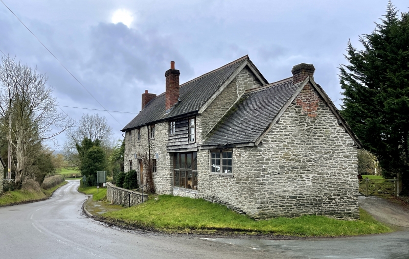
Location: Prominent position at village crossroads.
County: Powys
Community: Old Radnor (Pencraig)
Community: Old Radnor
Locality: Evenjob
Traditional County: Radnorshire
Tagged with: Smithy
Early C19.
Two storeys with adjoining lofted stable and single-storey former smithy. Coursed rubble, rendered to left gable, slate roofs, projecting rendered end stack to left with offsets and bake oven; tall brick stack to front right, brick end stack to smithy. Three-window range has small-panel, metal-framed casements, central boarded front door, boarded canopy porch with slate roof. Boarded pitching door and small-paned window to stable loft.
Group value with Courtyard Cottages opposite.
External links are from the relevant listing authority and, where applicable, Wikidata. Wikidata IDs may be related buildings as well as this specific building. If you want to add or update a link, you will need to do so by editing the Wikidata entry.


Other nearby listed buildings
