Approximate Location Map
Large Map »
Latitude: 51.9965 / 51°59'47"N
Longitude: -4.9682 / 4°58'5"W
OS Eastings: 196330
OS Northings: 237274
OS Grid: SM963372
Mapcode National: GBR CL.J6BY
Mapcode Global: VH1QM.T2WV
Plus Code: 9C3QX2WJ+HP
Entry Name: Bodmor
Listing Date: 24 November 1978
Last Amended: 7 January 2002
Grade: II
Source: Cadw
Source ID: 12329
Building Class: Domestic
ID on this website: 300012329
Location: Situated above the main road on a terrace with iron railings.
County: Pembrokeshire
Town: Fishguard
Community: Fishguard and Goodwick (Abergwaun ac Wdig)
Community: Fishguard and Goodwick
Locality: Lower Town
Traditional County: Pembrokeshire
Tagged with: House
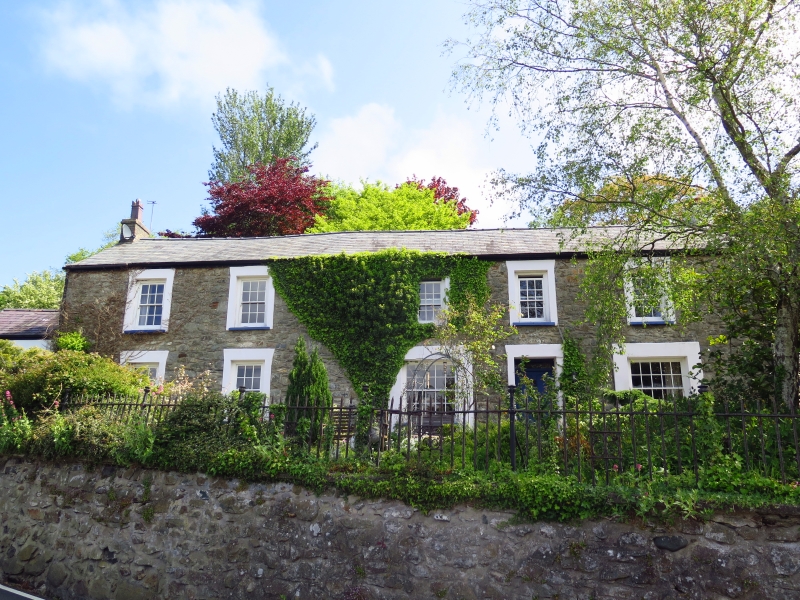
Single house, perhaps originally 2, though left part may have been a service range to larger right part, and later divided into 3. Set on iron-railed terrace above modern Newport Road, approached from the old Newport Road. Probably earlier C19. A building may be marked on the site on the 1844 tithe map.
House, rubble stone (stuccoed in 1978) with slate roof and small brick end stacks. Long 2-storey facade of 5 bays arranged in 2 portions, main 3-window range to right, 2-window shorter range to left. Renewed sash windows, in cement surrounds since removal of stucco. Main part, to right, has 12-pane sashes above, and large 20-pane sashes below each side of C20 door (4-panel door in 1978) with narrow overlight. Two bays to left have 12-pane sashes each floor. Left end wall is rendered and white painted, with C20 door. Attached and set back at left end is a much lower 2-storey wing altered in C20. White painted stucco with exposed cornerstones. Two C20 windows above with pair of dove holes to left of each, and a C20 ledged door to ground floor right and a window to left with brick heads. Dove holes in rubble stone gable end. Attached to left is a small rubble stone privy with ledged door and grouted roof.
Included as an earlier C19 house prominently set on the hillside above Lower Fishguard.
External links are from the relevant listing authority and, where applicable, Wikidata. Wikidata IDs may be related buildings as well as this specific building. If you want to add or update a link, you will need to do so by editing the Wikidata entry.


Other nearby listed buildings
