History in Structure

Walls of Churchyard of Church of St Mary

A Grade II Listed Building in Newport, Pembrokeshire

More Photos »
Approximate Location Map
Large Map »

Coordinates

Latitude: 52.0147 / 52°0'52"N

Longitude: -4.8316 / 4°49'53"W

OS Eastings: 205779

OS Northings: 238927

OS Grid: SN057389

Mapcode National: GBR CR.HB5Q

Mapcode Global: VH2MZ.6MKD

Plus Code: 9C4Q2579+V8

Entry Name: Walls of Churchyard of Church of St Mary

Listing Date: 14 April 1992

Last Amended: 16 May 2001

Grade: II

Source: Cadw

Source ID: 12485

Building Class: Religious, Ritual and Funerary

ID on this website: 300012485

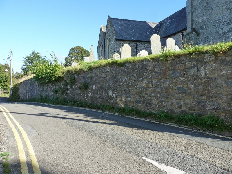
Location: Enclosing churchyard wall of irregular shape extending from churchyard gates at road junction with Goat Street to College Square at S.

County: Pembrokeshire

Community: Newport (Trefdraeth)

Community: Newport

Built-Up Area: Newport

Traditional County: Pembrokeshire

Tagged with: Churchyard wall

Find accommodation in
Dinas

History

Churchyard probably laid out in present form in early C19 but extended to E and S in later C19.

Exterior

Neatly coursed rubble retaining walls, curving in at NW angle to double wrought-iron gates with iron lamp-holder overthrow. N side gate to Goat Street with steps down. One further entry from Church Street with double iron gate.

Reasons for Listing

Included for group value with parish church.

External Links

External links are from the relevant listing authority and, where applicable, Wikidata. Wikidata IDs may be related buildings as well as this specific building. If you want to add or update a link, you will need to do so by editing the Wikidata entry.

Recommended Books

Other nearby listed buildings

  • II* Church of Saint Mary
    Prominently sited on rising ground at the head of Saint Mary's Street.
  • II Lluest
    Situated on bend facing W, NW of Church of St Mary.
  • II The Church Chapel
    Situated at south end of street, facing down Goat Street.
  • II Castle Green
    The last two houses at S end of street, below castle grounds.
  • II Castle Green
    The last two houses at S end of street, below castle grounds.
  • I Newport Castle
    Situated prominently overlooking town. Approached from W via smaller lane named Feidr Felin on O.S. map. Penclawdd is address on electoral roll.
  • II Fronlas
    Situated towards upper end of terraced row, between Fountain House and Ty Twt.
  • II Ffynnon Felin
    Situated just E of Mill Lane, opposite Castle Mill.

BritishListedBuildings.co.uk is an independent online resource and is not associated with any government department. All government data published here is used under licence. Please do not contact BritishListedBuildings.co.uk for any queries related to any individual listed building, planning permission related to listed buildings or the listing process itself.

British Listed Buildings is a Good Stuff website.