Approximate Location Map
Large Map »
Latitude: 53.185 / 53°11'5"N
Longitude: -3.0268 / 3°1'36"W
OS Eastings: 331482
OS Northings: 365810
OS Grid: SJ314658
Mapcode National: GBR 74.398L
Mapcode Global: WH88C.G6WP
Plus Code: 9C5R5XMF+X7
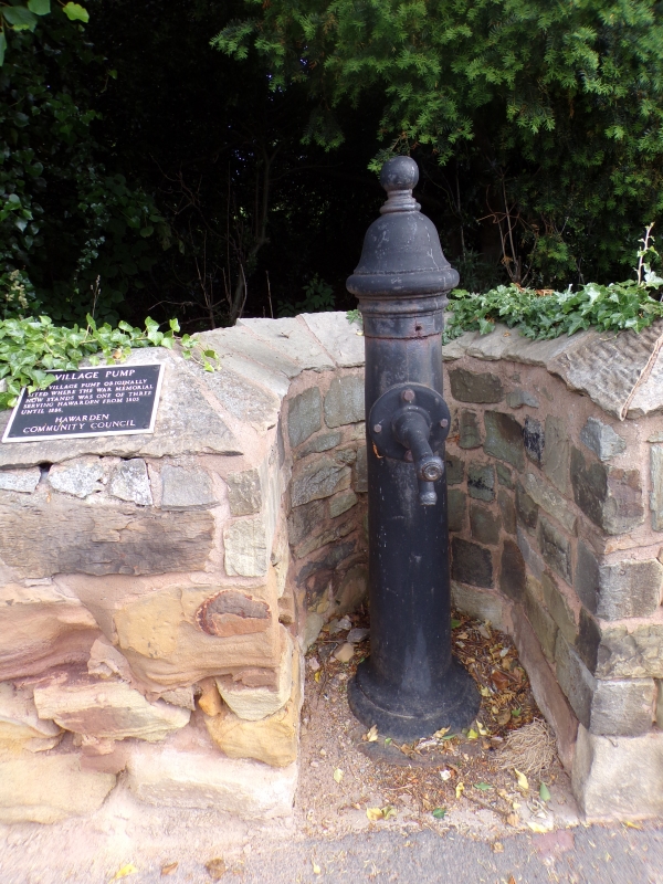
Entry Name: The Village Pump
Listing Date: 16 November 1994
Last Amended: 16 November 1994
Grade: II
Source: Cadw
Source ID: 15093
Building Class: Gardens, Parks and Urban Spaces
ID on this website: 300015093
Location: In a recess in the St. Deiniol's Library perimeter wall, facing the pavement.
County: Flintshire
Community: Hawarden (Penarlâg)
Community: Hawarden
Built-Up Area: Sandycroft
Traditional County: Flintshire
Tagged with: Architectural structure
One of 3 in regular use from 1805-1886 and originally sited where the War Memorial now stands. A cast iron column-shaped pump with moulded base and domed and ball-finialled head. No visible foundary mark.
Group value.
External links are from the relevant listing authority and, where applicable, Wikidata. Wikidata IDs may be related buildings as well as this specific building. If you want to add or update a link, you will need to do so by editing the Wikidata entry.


Other nearby listed buildings
