Approximate Location Map
Large Map »
Latitude: 53.1517 / 53°9'6"N
Longitude: -3.8374 / 3°50'14"W
OS Eastings: 277221
OS Northings: 363199
OS Grid: SH772631
Mapcode National: GBR 62.5JB7
Mapcode Global: WH65X.01YM
Plus Code: 9C5R5527+M2
Entry Name: Cwmannog Farmhouse AKA Gymmannog
Listing Date: 30 May 1996
Last Amended: 30 May 1996
Grade: II
Source: Cadw
Source ID: 16932
Building Class: Domestic
Also known as: Gymmannog
ID on this website: 300016932
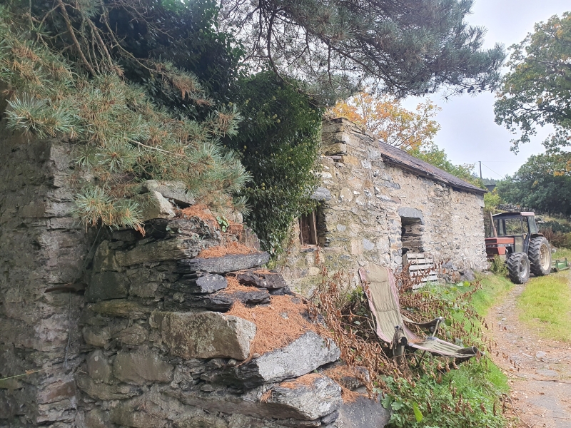
Location: Located 1.5 km W of Trefriw immediately to the N of the Trefriw-Llyn Geirionydd road, where it bridges the Afon Crafnant; set against the slope of a hill facing a random-cobbled enclosure.
County: Conwy
Town: Trefriw
Community: Trefriw
Community: Trefriw
Locality: Cwmannog
Traditional County: Caernarfonshire
Tagged with: Farmhouse
Early C17 storeyed end-chimney house of inside cross-passage type; a later C17 service wing to the rear forms a T-plan with the primary block. Single-storey C18 brew/wash house addition at the SE corner. Rubble construction with boulder foundations; pebble-dashed main and gable faces. Slate roof with rubble end chimneys, that to the R (former hall) the larger, that to the rear (service) wing squat; plain capping and weathercoursing. 2-window front with off-centre entrance (to L), stepped up and with original boarded and studded oak door; contemporary pegged frame. Recessed late C19 sash windows to both floors flanking the entrance, those to the ground floor with 2 panes above 3, those to the first floor of conventional type and placed under the eaves. Further sash window to first floor of W gable and modern windows on both floors to rear, the latter in primary openings with pronounced projecting lintels and cills. Single-storey service wing to rear built into the hill. This has a C19 4-pane sash in a late C17 gabled dormer facing E; later 2-pane window to ground floor W.
The wash/brew-house adjoins at a right-angle with the main block, which it partly overlaps to the R; construction as before with steeply-pitched roof continued to the E as a catslide over a later outshut; tall, rendered stack to SE gable. Central boarded door to main (farm) side with small, flanking 4-pane sashes, as before with similar arrangement at rear, though modern.
Original hinge post and block arrangement to door; crude later C17 oak inner porch. Whilst the partitions have been replaced (and that to the former hall, to the R, moved forward), the cross-passage arrangement is nevertheless still apparent and the opposing entrance survives. This has a Tudor-arched doorhead and contemporary pegged oak frame and has a later boarded door; it now leads into the rear service wing. Early C19 plain stick-baluster stair in former passage; boarded partitions to hall and former parlour. The latter has a plastered ceiling and C20 fireplace. Heavy beamed ceiling to hall with stopped-chamfered beams and joists and a wide fireplace with bressummer; a mural winding stair is known to exist to the L of the fireplace, though this has been plastered over. Cruder stopped-chamfered beams and a wide fireplace with bressummer to ground floor room of rear (service) wing. 4-bay roof with pegged, chamfered trusses of tie-beam and struts type.
An early C17 storeyed house retaining much of its original character.
Group value with other listed items at Cwmannog.
External links are from the relevant listing authority and, where applicable, Wikidata. Wikidata IDs may be related buildings as well as this specific building. If you want to add or update a link, you will need to do so by editing the Wikidata entry.


Other nearby listed buildings
