Latitude: 51.6704 / 51°40'13"N
Longitude: -5.0684 / 5°4'6"W
OS Eastings: 187919
OS Northings: 201309
OS Grid: SM879013
Mapcode National: GBR G5.HWHL
Mapcode Global: VH1S4.38CS
Plus Code: 9C3PMWCJ+5J
Entry Name: Lookout Tower
Listing Date: 26 January 1996
Last Amended: 26 January 1996
Grade: II
Source: Cadw
Source ID: 17167
Building Class: Maritime
ID on this website: 300017167
Location: At N side of B4320 road.
County: Pembrokeshire
Community: Angle
Community: Angle
Locality: Hardings Hill
Traditional County: Pembrokeshire
Tagged with: Architectural structure
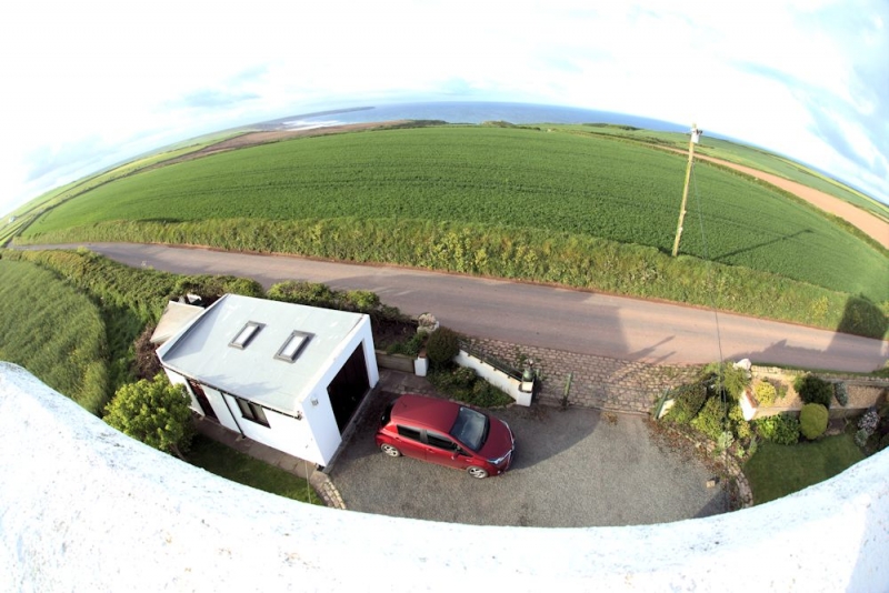
Built at the end of the C19, the Rocket Cart House (Board of Trade Rocket Apparatus Station no. 11) was the base for the cliff-rescue team with rockets, lines and breeches-buoys. It was in use until the 1930s, with a team of about 20 rescuers. In about 1970 it was taken as a holiday house and underwent minor alterations. It consists of a cart house originally with double-doors and a three-storey look-out tower. The whole site is at the N of the road, raised about 0.5 m above the adjacent field level and enclosed on three sides by a red brick wall about 1 m high. At front is a stone-block paved hardstanding area.
Tower, attached to house at E: Three storeys. Plinth about 0.5 m high. Originally facing-brickwork, now rendered in rough texture. Brick corbels and dentil course and parapet, also rendered. Ground storey: replaced door faces the front. First storey, facing S and N: pair of round-headed windows on a common sill with three sub-sill brackets. Second storey, facing W, N and S: triplet of similar windows on a common sill with four brackets. Flat roof.
Enclosure wall: original red-brick wall in Flemish Bond, local bricks.
Listed as a very prominent local landmark on a raised vantage point and as a significant monument to the Coastguard Service.
External links are from the relevant listing authority and, where applicable, Wikidata. Wikidata IDs may be related buildings as well as this specific building. If you want to add or update a link, you will need to do so by editing the Wikidata entry.


Other nearby listed buildings