Approximate Location Map
Large Map »
Latitude: 51.715 / 51°42'54"N
Longitude: -4.6952 / 4°41'42"W
OS Eastings: 213905
OS Northings: 205251
OS Grid: SN139052
Mapcode National: GBR GF.55HP
Mapcode Global: VH2PL.K5P2
Plus Code: 9C3QP883+2W
Entry Name: Saundersfoot Railway Tunnel (South)
Listing Date: 7 May 1997
Last Amended: 7 May 1997
Grade: II
Source: Cadw
Source ID: 18439
Building Class: Transport
ID on this website: 300018439
Location: On the coastal pedestrian route between Saundersfoot and Wiseman's Bridge, known now as the Miners' Walk. It is one of a group of three tunnels on the Countryside Commission's Pembrokeshire Coast Path
County: Pembrokeshire
Community: Saundersfoot
Community: Saundersfoot
Locality: Coppet Hall
Built-Up Area: Saundersfoot
Traditional County: Pembrokeshire
Tagged with: Railway tunnel
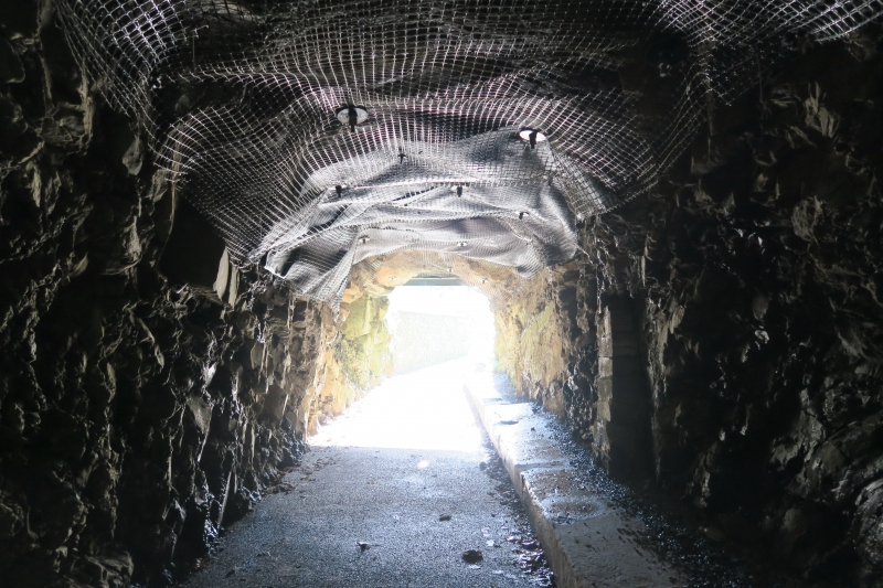
These tunnels are part of the Saundersfoot Railway, which was authorised under an Act of 31 June 1829, promoted by Sir Richard Philipps and others. The planned branch to Wiseman's Bridge was estimated to cost £2131. It was not immediately built, but the S tunnel was in use by 1832 and the others by 1834. The railway was laid to the gauge of 4 ft (1.2 m), and the tunnels were built to a width and height of 2.4 m. They served the important traffic between Saundersfoot and Stepaside, which was especially important as the iron industry there developed. The railway was never used officially for public transport. In 1874 a locomotive was introduced on this line for the first time, specially constructed for the limited dimensions of the tunnels. The track was re-laid to carry it. The locomotive was a saddle-tank design by Manning Wardle. The railway remained in use until 1939 when the rails were scrapped. The route is now a public walk.
The S tunnel joins The Strand in Saundersfoot to coppet Hall. (The middle and N tunnels are on the continuation route N past Coppet Hall).
Tunnel N portal and partial lining in local Carboniferous sandstone. In places where firmer strata were encountered the native rock was left unlined. The lining is generally 0.3 m in thickness. The width is 2.4 m and the walls 1.2 m high vertically with a semicircular vault. The tunnel is about 50 m in length, mostly lined.
Listed as an important relic of an exceptionally early railway and for group value with the other listed relics of the railway.
External links are from the relevant listing authority and, where applicable, Wikidata. Wikidata IDs may be related buildings as well as this specific building. If you want to add or update a link, you will need to do so by editing the Wikidata entry.


Other nearby listed buildings
