Approximate Location Map
Large Map »
Latitude: 51.893 / 51°53'34"N
Longitude: -3.2841 / 3°17'2"W
OS Eastings: 311729
OS Northings: 222382
OS Grid: SO117223
Mapcode National: GBR YT.QXPG
Mapcode Global: VH6C7.1P56
Plus Code: 9C3RVPV8+59
Entry Name: Glynderi
Listing Date: 17 December 1998
Last Amended: 17 December 1998
Grade: II
Source: Cadw
Source ID: 21190
Building Class: Domestic
ID on this website: 300021190
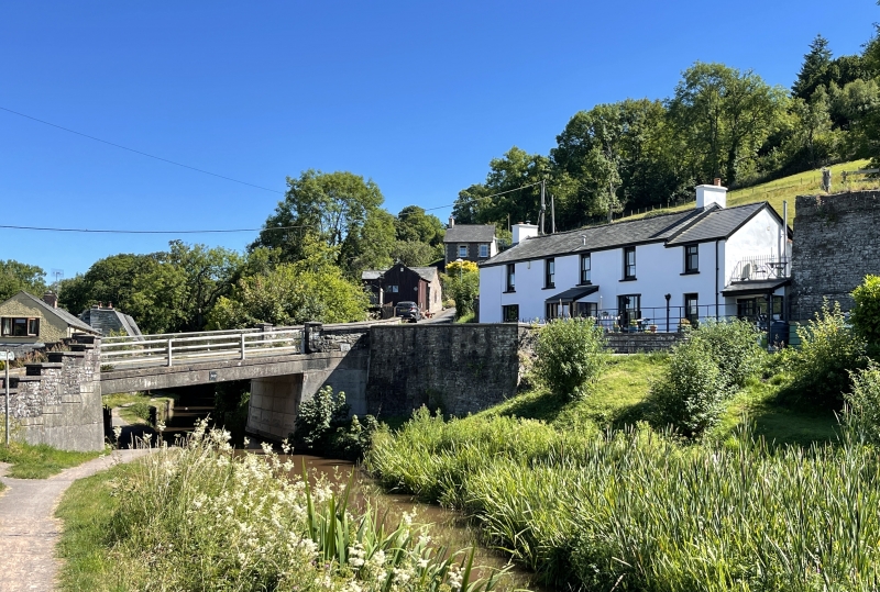
Location: Facing the Monmouthshire and Brecon canal and Bridge No. 142 on the E side of Talybont and immediately adjacent to the limekilns at Brynhyfryd.
County: Powys
Community: Talybont-on-Usk (Tal-y-bont ar Wysg)
Community: Talybont-on-Usk
Locality: Talybont on Usk
Traditional County: Brecknockshire
Tagged with: House
Mid C19, probable connections with the former Talybont basin; this section of the Brecknock and Abergavenny Canal, was opened c 1800. The Brynoer tramroad from the Trefil quarries terminated nearby and the house is immedately adjacent to the bank of limekilns from whence lime was loaded onto barges in the Talybont basin.
A long 2 storey house with shallow pitched Welsh slate roof and rendered end stacks, built into the bank. 4-window range of margin glazed sashes with shallow sills to first floor; one similar centre left to ground floor with larger tripartite sashes at either end under very slighly cambered arches. Doorway centre left has timber porch with shallow pediment and square-section piers. Stepped back to right a hipped roof wing with similar windows. Bounded to front by a low rubble wall with slender hooped railings and gate.
Interior not inspected at the time of survey (2nd September 1997).
Included for its prominent position in the historic canalside complex at the former Talybont Basin and for group value with Brynhyfryd and the limekilns which it adjoins.
External links are from the relevant listing authority and, where applicable, Wikidata. Wikidata IDs may be related buildings as well as this specific building. If you want to add or update a link, you will need to do so by editing the Wikidata entry.


Other nearby listed buildings
