Approximate Location Map
Large Map »
Latitude: 51.4865 / 51°29'11"N
Longitude: -3.1789 / 3°10'43"W
OS Eastings: 318241
OS Northings: 177054
OS Grid: ST182770
Mapcode National: GBR KJK.52
Mapcode Global: VH6F6.VW9T
Plus Code: 9C3RFRPC+JC
Entry Name: Public Conveniences
Listing Date: 30 April 1999
Last Amended: 30 April 1999
Grade: II
Source: Cadw
Source ID: 21670
Building Class: Health and Welfare
ID on this website: 300021670
Location: To rear (N) of National Museum.
County: Cardiff
Community: Castle (Castell)
Community: Castle
Built-Up Area: Cardiff
Traditional County: Glamorgan
Tagged with: Architectural structure
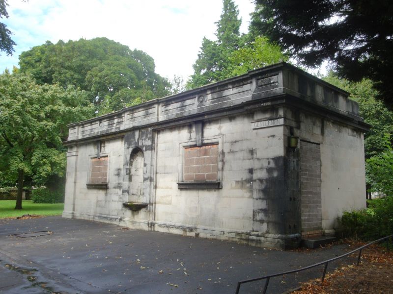
Early C20 public convenience block.
Single-storey block in concrete imitating Portland Stone. Classical detailing; parapet, central niche flanked by rectangular windows (blocked)with keystones; separate entrance doorways to N and S returns.
Listed for group value with other buildings in Cathays Park.
External links are from the relevant listing authority and, where applicable, Wikidata. Wikidata IDs may be related buildings as well as this specific building. If you want to add or update a link, you will need to do so by editing the Wikidata entry.


Other nearby listed buildings
