Approximate Location Map
Large Map »
Latitude: 52.8311 / 52°49'52"N
Longitude: -4.6137 / 4°36'49"W
OS Eastings: 224016
OS Northings: 329156
OS Grid: SH240291
Mapcode National: GBR 52.TMQL
Mapcode Global: WH44T.338F
Plus Code: 9C4QR9JP+CG
Entry Name: Pigsty at Frondeg
Listing Date: 17 January 2000
Last Amended: 17 January 2000
Grade: II
Source: Cadw
Source ID: 22787
Building Class: Domestic
ID on this website: 300022787
Location: Situated a few metres SE of the cottage, outside the walled enclosures of its garden plot; between Fron Deg and Bryn Ffynnon.
County: Gwynedd
Community: Aberdaron
Community: Aberdaron
Locality: Rhiw
Traditional County: Caernarfonshire
Tagged with: Pigsty
The location suggests that the pigsty was originally associated with Frondeg, so probably contemporary with the cottage, and therefore mid C19.
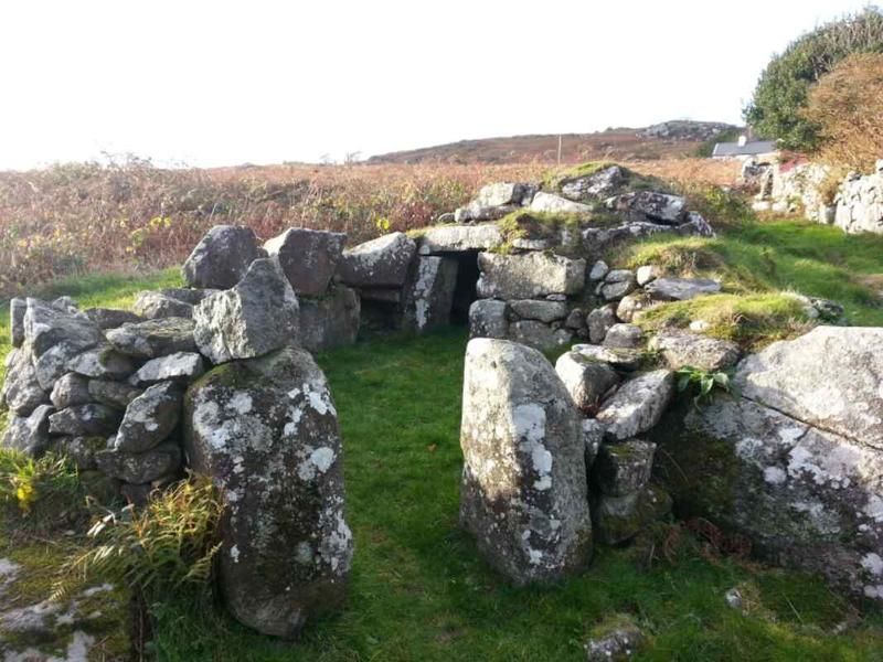
A rare example of a rough stone circular pigsty, partially built into the rise of the ground and making use of boulders on this rough upland site. The pigsty is of drystone rubble construction, roughly domed, but finished internally with flat slabs. the walls of its small enclosure also survive, with gate piers marking the entrance.
Listed as a very well-preserved example of a primitive vernacular building form - thought to have once been traditional, known surviving examples are now scarce. It forms a group with the cottage at Frondeg, together constituting an expecially complete example ofa tiny upland small-holding.
External links are from the relevant listing authority and, where applicable, Wikidata. Wikidata IDs may be related buildings as well as this specific building. If you want to add or update a link, you will need to do so by editing the Wikidata entry.


Other nearby listed buildings
