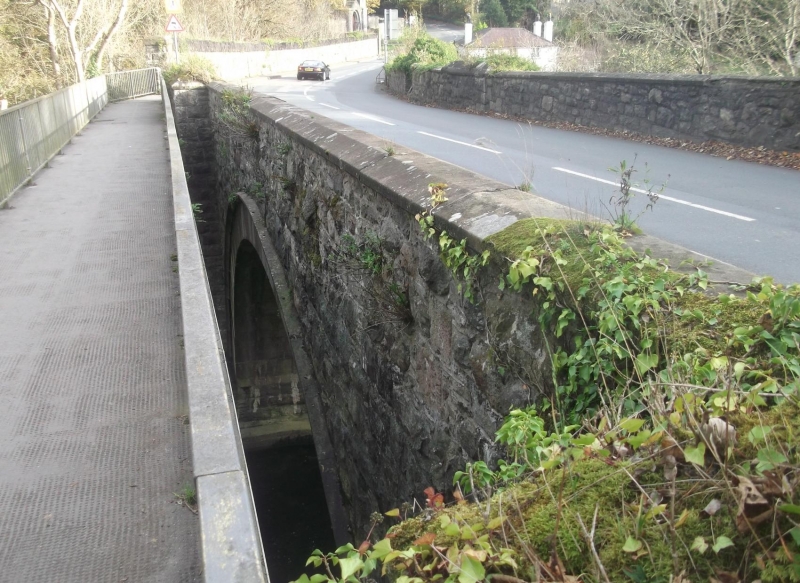
Pont Tal-y-bont (partly in Llanllechid community)
A Grade II Listed Building in Llandygai, Gwynedd
Coordinates
Latitude: 53.2166 / 53°12'59"N
Longitude: -4.0953 / 4°5'43"W
OS Eastings: 260188
OS Northings: 370887
OS Grid: SH601708
Mapcode National: GBR 5R.17NN
Mapcode Global: WH548.2D3Y
Plus Code: 9C5Q6W83+JV
Entry Name: Pont Tal-y-bont (partly in Llanllechid community)
Listing Date: 9 March 2000
Grade: II
Source: Cadw
Source ID: 23402
Building Class: Transport
ID on this website: 300023402
Location: Spans the Afon Ogwen on the road between Llanygai and Tal-y-bont; park land of Penrhyn Park to north.
County: Gwynedd
Community: Llandygai (Llandygái)
Community: Llandygai
Traditional County: Caernarfonshire
Other nearby listed buildings
-
II
Horse Drinking Trough and Fountain
Built into the park wall to Penrhyn Castle on the north side of the road between Llandygai and Tal-y-bont approximately 40m west of the bridge over the Afon Ogwen.
-
II
Pont Tal-y-bont (partly in Llandygai community)
Spans the Afon Ogwen on the road between Llanygai and Tal-y-bont; park land of Penrhyn Park to north.
-
II*
Wyatt Memorial at the Church of St Tegai
Located directly to the south of the chancel of the Church of St Tegai.
-
II
Former Sawmill Manager's House
Situated directly to the east of Tre-felin Cottages at the entrance to the former Tre-felin Saw Mill in the shadow of the viaduct of the Chester to Holyhead railway; curved rubblestone wall with slate
-
II
Tal-y-bont Lodge
Situated on north side of former Bangor-Conwy road at junction with minor road to Tal-y-bont; the lodge forms part of the wall to Penrhyn Park, which is here set back from the road with piers at each
-
II*
Church of St Tegai
Located at north-eastern end of village.
-
II
Ysgol Llandygai & School House
Situated in centre of village to south-west of church; school has playground to front and front garden of School House is boarded by substantial rubblestone block wall with regularly spaced buttresses
-
II
Tre-felin Cottages
One of a series of 4 paired cottages following curve of road and thus forming a crescent to west of the former Tre-felin Sawmill; low rubblestone wall to roadside, while to south are long gardens terr