History in Structure

The Bier House in St Andrew's Churchyard

A Grade II Listed Building in Dinas Powys, Vale of Glamorgan

More Photos »
Approximate Location Map
Large Map »

Coordinates

Latitude: 51.4354 / 51°26'7"N

Longitude: -3.2409 / 3°14'27"W

OS Eastings: 313842

OS Northings: 171441

OS Grid: ST138714

Mapcode National: GBR HV.NX2S

Mapcode Global: VH6FK.S51Y

Plus Code: 9C3RCQP5+5M

Entry Name: The Bier House in St Andrew's Churchyard

Listing Date: 3 May 2002

Last Amended: 3 May 2002

Grade: II

Source: Cadw

Source ID: 26508

Building Class: Religious, Ritual and Funerary

ID on this website: 300026508

Location: In the SW corner of the churchyard facing E.

County: Vale of Glamorgan

Town: Cardiff

Community: Dinas Powys

Community: Dinas Powys

Locality: St Andrews Major

Traditional County: Glamorgan

Tagged with: Architectural structure

Find accommodation in
Dinas Powis

History

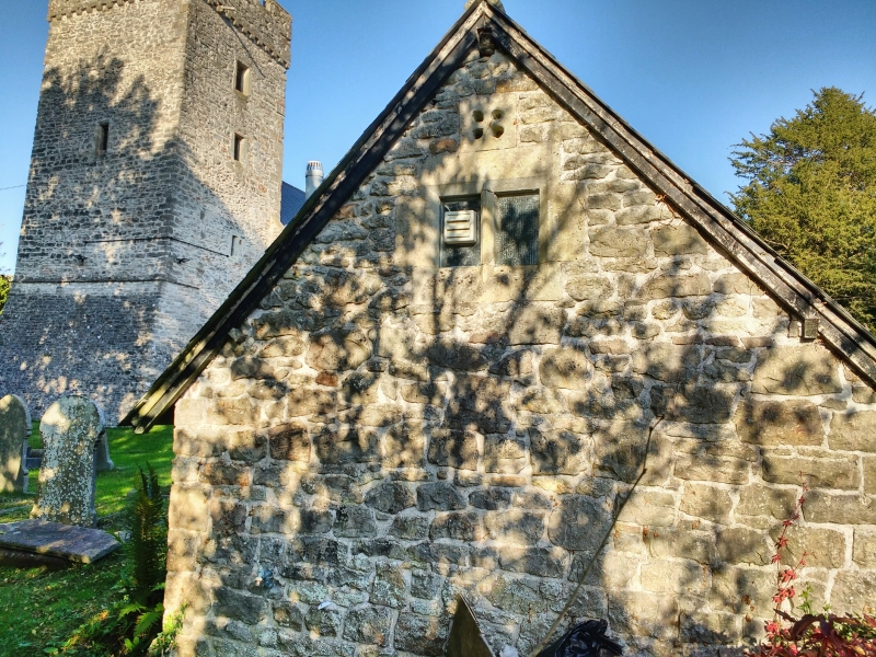
An unusual example of previously more common type of churchyard building; contains the bier on which coffins are carried for funerals. A building is shown in this area on the Tithe Map of 1840 though not on the first edition OS map surveyed 1878.

Exterior

Small single storey rubble stone building with ashlar dressings and a deep pitched slate roof. Gable end facade has a chamfered and decoratively stopped Tudor-arched doorway with a small rectangular 2-light chamfered mullioned window above; similar window in opposite gable end.

Reasons for Listing

Listed as a survival of an unusual building type. Group value with the church, the cross and the Old Rectory.

External Links

External links are from the relevant listing authority and, where applicable, Wikidata. Wikidata IDs may be related buildings as well as this specific building. If you want to add or update a link, you will need to do so by editing the Wikidata entry.

Recommended Books

Other nearby listed buildings

  • II* The Old Rectory
    Situated on SW side of the church, within the grounds of The Rectory and reached by a drive through that property.
  • II Churchyard cross in St Andrew's Churchyard
    Standing S of the church.
  • II* Church of St Andrew
    On low-lying ground in the centre of the hamlet, a still rural community NW of the urban development of Dinas Powys, standing in a roughly rectangular churchyard with retaining wall incorporating ston
  • II Garn-hill and attached garden terrace
    On a south facing slope NE of the hamlet of St Andrews Major, reached by a long drive from the hamlet and set in terraced gardens.
  • II Lon Twyn
    On rising ground NW of the village centre, set within terraced gardens with views S over the Bristol Channel.
  • II The Mount
    Facing the Common on ground rising from and SW of the village centre. Set back from the road in a walled garden with entrance comprising tall rendered piers and tall decorative wrought iron gates.
  • II Dinas Powys Parish Hall
    Just to W and on rising ground above the village centre, on a railed and walled terrace of random stone reached by steps.
  • II Remains of Dinas Powis Castle
    On a wooded spur in Castle Wood, immediately above the C20 development of Lettons Way and reached by footpath from there.

BritishListedBuildings.co.uk is an independent online resource and is not associated with any government department. All government data published here is used under licence. Please do not contact BritishListedBuildings.co.uk for any queries related to any individual listed building, planning permission related to listed buildings or the listing process itself.

British Listed Buildings is a Good Stuff website.