Approximate Location Map
Large Map »
Latitude: 52.8274 / 52°49'38"N
Longitude: -3.4494 / 3°26'57"W
OS Eastings: 302437
OS Northings: 326524
OS Grid: SJ024265
Mapcode National: GBR 6L.TW0W
Mapcode Global: WH67M.Z6L9
Plus Code: 9C4RRHG2+X6
Entry Name: Lychgate of St Melangell's Church
Listing Date: 23 May 2003
Last Amended: 23 May 2003
Grade: II
Source: Cadw
Source ID: 81052
Building Class: Religious, Ritual and Funerary
ID on this website: 300081052
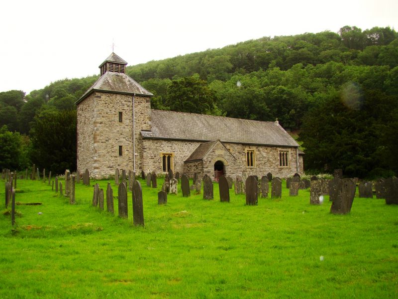
Location: At the south of the churchyard of St Melangell's church, Pennant Melangell. Stile at west side.
County: Powys
Community: Llangynog (LLangynog)
Community: Llangynog
Locality: Cwm Pennant
Traditional County: Montgomeryshire
Tagged with: Lychgate
Dated on the authority of both Archdeacon Thomas and Dr Ralegh Radford, who appear to have seen a date on the structure, as 1632, though the evidence has apparently not been recorded. Carved stones belonging to the shrine of St Melangell in the church were removed during 1989-92 for use in the reconstruction of the shrine.
A lychgate of uncoursed local slate masonry, the front and rear arches both brought to an approximately rounded form with corbelling at each side and a short lintel. The front opening has cyclopean jambs; one upright jamb at rear. Oak rafters and slate roof with tile ridge, both gables with slate coping resting upon roughly corbelled kneelers.
Slate side benches. Corbelled shelves at top of walls. Decorative iron gates at inner archway only. Recent slate plaque on front gable, concealing point where stones for the St Melangell shrine were recovered.
A fine example of a C17 vernacular lychgate at the entrance to the grade I listed church of St Melangell; listed for group value also.
External links are from the relevant listing authority and, where applicable, Wikidata. Wikidata IDs may be related buildings as well as this specific building. If you want to add or update a link, you will need to do so by editing the Wikidata entry.


Other nearby listed buildings
