Approximate Location Map
Large Map »
Latitude: 52.8916 / 52°53'29"N
Longitude: -4.0708 / 4°4'14"W
OS Eastings: 260779
OS Northings: 334687
OS Grid: SH607346
Mapcode National: GBR 5S.PTWP
Mapcode Global: WH55T.FLR3
Plus Code: 9C4QVWRH+JM
Entry Name: Bridge to SW of Rhosigor
Listing Date: 30 December 2004
Last Amended: 30 December 2004
Grade: II
Source: Cadw
Source ID: 83431
Building Class: Transport
ID on this website: 300083431
Location: Set back from the SW side of the B4573 to SW of Rhosigor
County: Gwynedd
Community: Talsarnau
Community: Talsarnau
Locality: Glan-y-wern
Traditional County: Merionethshire
Tagged with: Bridge Road bridge
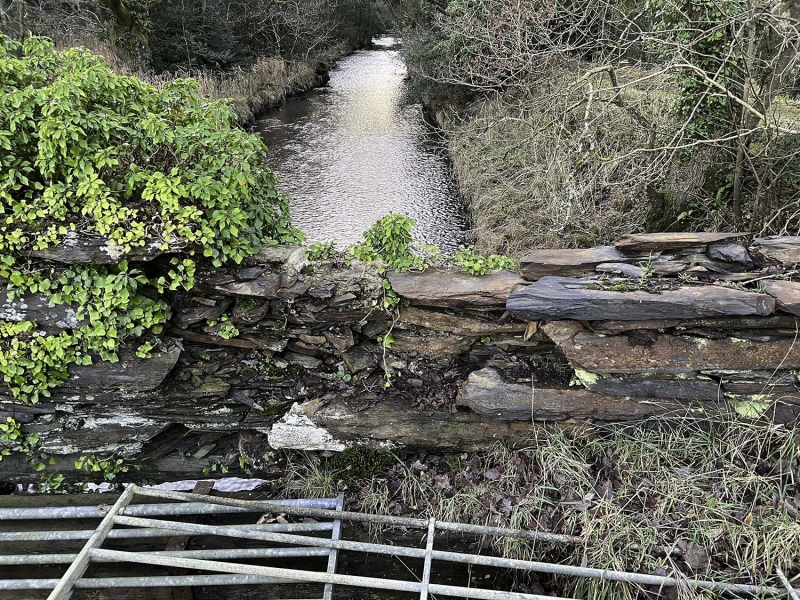
Probably C18 bridge, predates the B4573 and was in place prior to the 1802 Act to reclaim the land at Traeth Mawr.
Simple road bridge comprising a single span. Built of rubble masonry with large stones forming corbels to the flat lintel which forms the span; low rubble parapet walls.
Included as a C18 road bridge of unusual type, with flat lintel.
External links are from the relevant listing authority and, where applicable, Wikidata. Wikidata IDs may be related buildings as well as this specific building. If you want to add or update a link, you will need to do so by editing the Wikidata entry.


Other nearby listed buildings
