Approximate Location Map
Large Map »
Latitude: 53.2215 / 53°13'17"N
Longitude: -3.0638 / 3°3'49"W
OS Eastings: 329071
OS Northings: 369907
OS Grid: SJ290699
Mapcode National: GBR 73.10UR
Mapcode Global: WH770.X976
Plus Code: 9C5R6WCP+HF
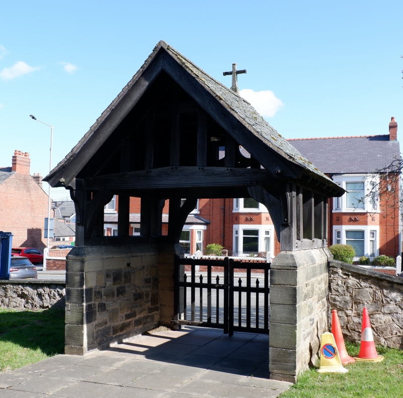
Entry Name: Lychgate at Church of St Mark
Listing Date: 26 August 2005
Last Amended: 26 August 2005
Grade: II
Source: Cadw
Source ID: 85260
ID on this website: 300085260
Location: Located on the S side of the main road, on the W side of Connah's Quay, and fronting a lay-by. The lychgate is flanked by churchyard boundary walls which were rebuilt when the road was widened in the
County: Flintshire
Town: Deeside
Community: Connah's Quay (Cei Connah)
Community: Connah's Quay
Built-Up Area: Connah's Quay
Traditional County: Flintshire
Tagged with: Lychgate
Built in 1917 as a memorial to the Rev. Thomas Williams, vicar of Connah's Quay .
Side walls and front piers of snecked yellow sandstone with chamfered stone copings, supporting a timber-framed superstructure, the timbers pegged. Swept gabled slate-covered roof surmounted by a crucifix. Each side wall supports a tier of open box panels immediately under the eaves. The front gable has a cambered decorated tie-beam bearing rosettes, supported by curved braces; vertical struts and collar above, the central panel bearing a decorative quatrefoil. The rear gable has a plain cambered tie-beam with vertical struts above.
Four narrow collar trusses to roof structure. On the interior side of the E wall is an inscription: 'In memory of Rev. Thomas Williams, Vicar, 1909-1917'.
Listed as a well-detailed early-C20 memorial lychgate in Arts & Crafts tradition, and for group value with the Church of St Mark.
External links are from the relevant listing authority and, where applicable, Wikidata. Wikidata IDs may be related buildings as well as this specific building. If you want to add or update a link, you will need to do so by editing the Wikidata entry.


Other nearby listed buildings
