Approximate Location Map
Large Map »
Latitude: 51.7619 / 51°45'42"N
Longitude: -2.9554 / 2°57'19"W
OS Eastings: 334161
OS Northings: 207453
OS Grid: SO341074
Mapcode National: GBR J7.099W
Mapcode Global: VH79F.QZG7
Plus Code: 9C3VQ26V+QV
Entry Name: Pistyll
Listing Date: 9 December 2005
Last Amended: 26 June 2006
Grade: II
Source: Cadw
Source ID: 87185
Building Class: Domestic
ID on this website: 300087185
Location: About 800m north-west of Llanfair Kilgeddin village and approached down a track off the south side of the minor road going towards Llanellen.
County: Monmouthshire
Town: Abergavenny
Community: Llanover (Llanofer)
Community: Llanover
Locality: Llanfair Kilgeddin
Traditional County: Monmouthshire
Tagged with: House
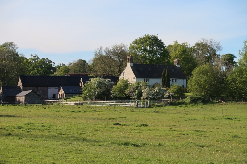
c1600 house of unusual type with unheated central room. The front kitchen wing and porch are later additions and many of the external features have been replaced in the C20, but the internal character of the building survives well, with original roof trusses, beams, and winding stairs to each end.
The house is completely covered in roughcast render, over local stone, concrete tile roof with
gable-end red sandstone stacks. Single depth central entry plan with a kitchen wing added probably c1700 (Fox and Raglan) and a later porch. Two storeys and garret.
Front elevation: Four bays of differing widths. From the left the first bay is hidden by the projecting two storey kitchen wing (two C20 rooflights) which has two windows below and one in the gable above: window in the right return and door in the left return of the wing. Bay 2 has a 3-light window below and a 2-light one above. Bay 3 has the gabled entrance porch with a replacement C17 type door and a 2-light window above. Bay 4 is wider and has a 3-light window on each floor. All windows are late C20 factory units. Steeply pitched plain roof with stacks to either gable, larger on the right.
The right return has a gable with small stair window for the garret flight, and a later window to garret; disturbed masonry suggests blocked window or door.
The left return has a slight projection for the stair with a small 2-light timber casement. To the left is another dripstone. Above this is the solar window, a 2-light casement under a dripmould, and another one above to light the garret.
Rear elevation: This is also in four bays. From the left Bay 1 has a 4 light window with central French doors and a 3-light window above. Bay 2 has the cross-passage door and is blind above. Bay 3 has a 2-light window to either floor. Bay 4 has a 3-light window to either floor and a small door to the right. Four C20 rooflights in the roof.
The cross-passage partitions have gone but the planning otherwise survives well. Both the main rooms have open fireplaces with oak lintels, but both have been reconstructed. The left hand room has a stone spiral stair to the left and this goes to solid oak treads for the spiral to the attic. The stair in the right hand room is to the right. Many close set plainly chamfered cross-beams with step stops, a number of which are replacements. The unheated central room is framed and plastered. Plain upper rooms. Roof trusses with tenoned collars, apart from L end truss which is notched.
Included for its special interest as a C17 house of unusual plan type, which despite loss of external detail, retains original fabric and good character internally.
External links are from the relevant listing authority and, where applicable, Wikidata. Wikidata IDs may be related buildings as well as this specific building. If you want to add or update a link, you will need to do so by editing the Wikidata entry.


Other nearby listed buildings
