Approximate Location Map
Large Map »
Latitude: 51.0666 / 51°3'59"N
Longitude: 0.6805 / 0°40'49"E
OS Eastings: 587910
OS Northings: 133109
OS Grid: TQ879331
Mapcode National: GBR QW8.4VN
Mapcode Global: FRA D699.JY2
Plus Code: 9F323M8J+J6
Entry Name: Westfield House
Listing Date: 8 May 1950
Grade: II*
Source: Historic England
Source ID: 1071128
English Heritage Legacy ID: 179845
ID on this website: 101071128
Location: Tenterden, Ashford, Kent, TN30
County: Kent
District: Ashford
Civil Parish: Tenterden
Built-Up Area: Tenterden
Traditional County: Kent
Lieutenancy Area (Ceremonial County): Kent
Tagged with: House
1.
1715 WEST CROSS
(North Side)
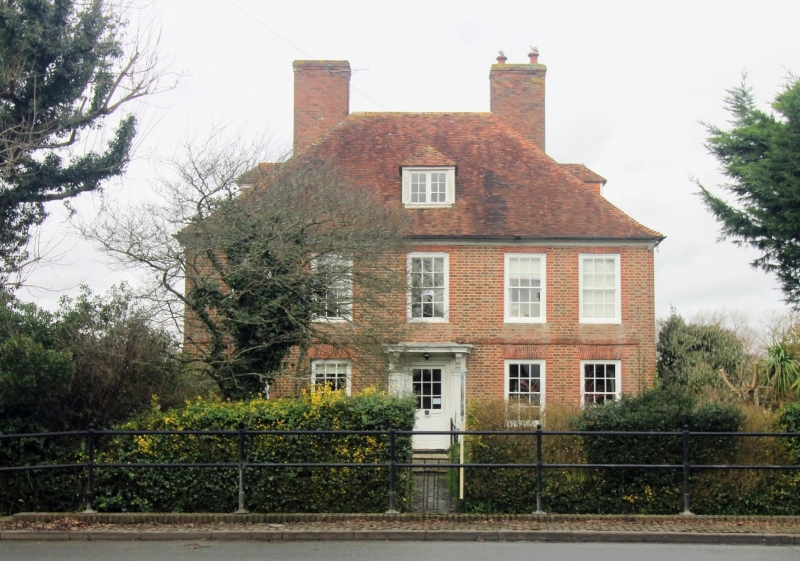
No 18 (Westfield House)
TQ 8733 SE 2/64 8.5.50.
II*
2.
A large early C18 house, now subdivided. 2 storeys red brick with grey
headers. Steeply pitched hipped tiled roof and eaves cornice. Stringcourse.
The east half of the house has casement windows, the west half sash windows
with glazing bars intact. Doorcase with fluted pilasters and flat hood
over. Modern addition at ground floor level only to the east.
Listing NGR: TQ8790233120
External links are from the relevant listing authority and, where applicable, Wikidata. Wikidata IDs may be related buildings as well as this specific building. If you want to add or update a link, you will need to do so by editing the Wikidata entry.


Other nearby listed buildings
