Approximate Location Map
Large Map »
Latitude: 51.0662 / 51°3'58"N
Longitude: 0.6812 / 0°40'52"E
OS Eastings: 587958
OS Northings: 133076
OS Grid: TQ879330
Mapcode National: GBR QW8.51K
Mapcode Global: FRA D699.K65
Plus Code: 9F323M8J+FF
Entry Name: Cherry Tree House
Listing Date: 8 April 1970
Grade: II
Source: Historic England
Source ID: 1203439
English Heritage Legacy ID: 179806
ID on this website: 101203439
Location: Tenterden, Ashford, Kent, TN30
County: Kent
District: Ashford
Civil Parish: Tenterden
Built-Up Area: Tenterden
Traditional County: Kent
Lieutenancy Area (Ceremonial County): Kent
Tagged with: House
1.
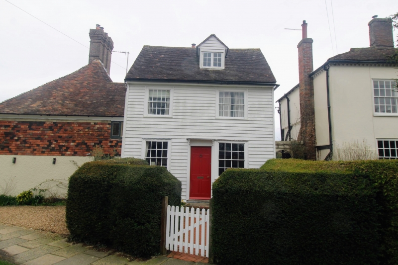
1715 SMALLHYTHE ROAD
(East Side)
No 1 (Cherry Tree House)
TQ 8733 SE 2/67 8.4.70.
II GV
2.
C18. 2 stcreys weatherboarded. Tiled roof with 1 hipped weatherboarded
dormer. 2 sashes with glazing bars intact. Porch with round-headed doorcase.
2 store extension to rear, also weatherboarded.
All the listed buildings on the east side from Nos 1 to 17 form a group with
Nos 9 and 11 West Cross.
Listing NGR: TQ8796433075
External links are from the relevant listing authority and, where applicable, Wikidata. Wikidata IDs may be related buildings as well as this specific building. If you want to add or update a link, you will need to do so by editing the Wikidata entry.


Other nearby listed buildings
