Approximate Location Map
Large Map »
Latitude: 51.1813 / 51°10'52"N
Longitude: 0.0747 / 0°4'29"E
OS Eastings: 545108
OS Northings: 144492
OS Grid: TQ451444
Mapcode National: GBR LMM.V0K
Mapcode Global: VHHQ3.7KVT
Plus Code: 9F3253JF+GV
Entry Name: Large Barn to East of Stanford's End
Listing Date: 16 January 1975
Grade: II
Source: Historic England
Source ID: 1071954
English Heritage Legacy ID: 357222
ID on this website: 101071954
Location: Sevenoaks, Kent, TN8
County: Kent
District: Sevenoaks
Town: Sevenoaks
Civil Parish: Edenbridge
Traditional County: Kent
Lieutenancy Area (Ceremonial County): Kent
Church of England Parish: Edenbridge St Peter and St Paul
Church of England Diocese: Rochester
Tagged with: Barn
EDENBRIDGE STANFORD'S END
1.
5080
Hartfield Road
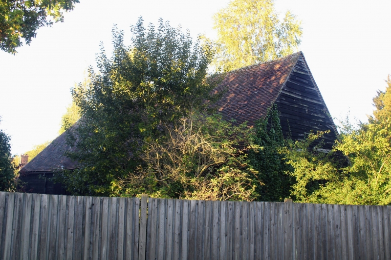
Large Barn to East of
Stanford's End
TQ 44 SE 53/397
II GV
2.
C16 or C17 weatherboarded barn with hipped tiled roof. Foundation of large,
roughly coursed rubble with some brick courses over.
Listing NGR: TQ4510844492
External links are from the relevant listing authority and, where applicable, Wikidata. Wikidata IDs may be related buildings as well as this specific building. If you want to add or update a link, you will need to do so by editing the Wikidata entry.


Other nearby listed buildings
