Approximate Location Map
Large Map »
Latitude: 51.1816 / 51°10'53"N
Longitude: 0.0747 / 0°4'29"E
OS Eastings: 545107
OS Northings: 144532
OS Grid: TQ451445
Mapcode National: GBR LMM.V0F
Mapcode Global: VHHQ3.7KVJ
Plus Code: 9F3253JF+JV
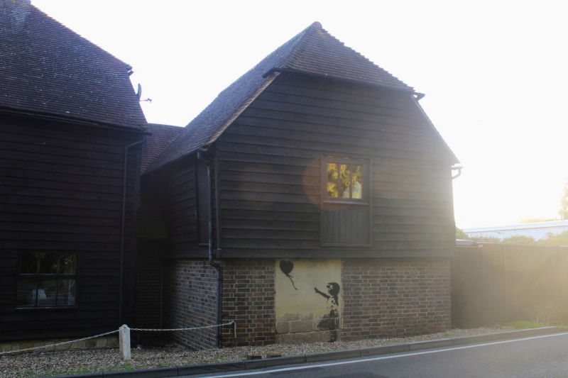
Entry Name: Granary Attached to Barn
Listing Date: 15 February 1988
Grade: II
Source: Historic England
Source ID: 1272495
English Heritage Legacy ID: 449088
ID on this website: 101272495
Location: Sevenoaks, Kent, TN8
County: Kent
District: Sevenoaks
Civil Parish: Edenbridge
Traditional County: Kent
Lieutenancy Area (Ceremonial County): Kent
Church of England Parish: Edenbridge St Peter and St Paul
Church of England Diocese: Rochester
Tagged with: Granary
TQ 44 SE EDENBRIDGE
HARTFIELD ROAD
53/2004 Granary attached to
Barn
GV II
Granary. C18. Ground floor brown brick in Susex bond and weatherboarded above
but north-west front is tile hung on the first floor. Half-hipped tiled roof.
North west front has boarded loading door and window with diamond mullions. 3 bays.
Interior has angled queen struts and through purlins. Diagonal wind braces.
Listing NGR: TQ4569843955
External links are from the relevant listing authority and, where applicable, Wikidata. Wikidata IDs may be related buildings as well as this specific building. If you want to add or update a link, you will need to do so by editing the Wikidata entry.


Other nearby listed buildings
