Approximate Location Map
Large Map »
Latitude: 51.2843 / 51°17'3"N
Longitude: 0.1502 / 0°9'0"E
OS Eastings: 550046
OS Northings: 156101
OS Grid: TQ500561
Mapcode National: GBR S9.SN4
Mapcode Global: VHHPK.KZ8B
Plus Code: 9F3275M2+P3
Entry Name: 1 and 3, Chevening Road
Listing Date: 16 January 1975
Grade: II
Source: Historic England
Source ID: 1085859
English Heritage Legacy ID: 356975
ID on this website: 101085859
Location: Chipstead, Sevenoaks, Kent, TN13
County: Kent
District: Sevenoaks
Civil Parish: Chevening
Built-Up Area: Sevenoaks
Traditional County: Kent
Lieutenancy Area (Ceremonial County): Kent
Church of England Parish: Chevening St Botolph
Church of England Diocese: Rochester
Tagged with: Building
1.
5280
TQ 5056 SW
3/107
CHEVENING
CHIPSTEAD
Chevening Road
(West side)
Nos 1 and 3
II
GV
2.
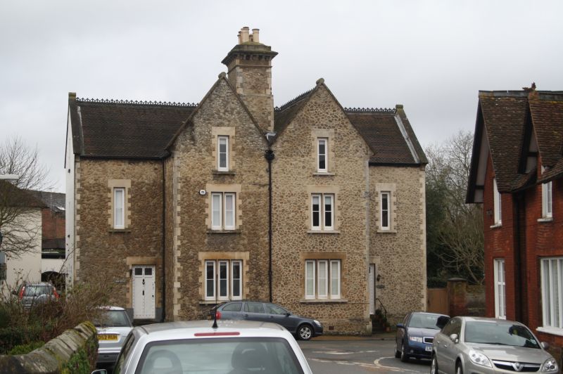
Tall, midd-cl9 pair, each 2 storeys and attic, 2 windows. Projecting inner
bays under stone-coped gables. Fairly high pitched roof with fancy tiles.
Tall centre stack with modillion cornice and blocking course. Random rubble
with freestone quoins and window dressings; and plinth coping. Windows long,
l-bar casements of 1, 2 and 3 lights. Studded doors of 2 long panels. Listed
partly for value in closing vista at end of High Street.
Nos 1 and 3 form a group with the screen wall to north and around the corner to
Mill Farm House, and with Nos 2 to 16 (even) High Street and their forecourt wall.
Listing NGR: TQ5004656101
External links are from the relevant listing authority and, where applicable, Wikidata. Wikidata IDs may be related buildings as well as this specific building. If you want to add or update a link, you will need to do so by editing the Wikidata entry.


Other nearby listed buildings
