Latitude: 54.1299 / 54°7'47"N
Longitude: -3.0981 / 3°5'53"W
OS Eastings: 328342
OS Northings: 471011
OS Grid: SD283710
Mapcode National: GBR 6NTP.29
Mapcode Global: WH72K.CGY8
Plus Code: 9C6R4WH2+XQ
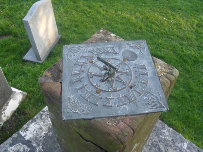
Entry Name: Sundial Approximately 17 Metres to South of St Cuthberts Church
Listing Date: 5 March 1990
Grade: II
Source: Historic England
Source ID: 1086838
English Heritage Legacy ID: 75777
ID on this website: 101086838
Location: St Cuthbert's Church, Aldingham, Westmorland and Furness, Cumbria, LA12
County: Cumbria
District: South Lakeland
Civil Parish: Aldingham
Traditional County: Lancashire
Lieutenancy Area (Ceremonial County): Cumbria
Church of England Parish: Aldingham St Cuthbert
Church of England Diocese: Carlisle
Tagged with: Sundial
SD 27 SE ALDINGHAM ALDINGHAM
19/5 Sundial approx 17m to south
of St Cuthbert's Church
(q.v.)
G.V. II
Sundial. Plate dated 1753. Stone. Base in form of mounting block with
3 steps. Square post has square plate with gnomon.
Listing NGR: SD2834271011
External links are from the relevant listing authority and, where applicable, Wikidata. Wikidata IDs may be related buildings as well as this specific building. If you want to add or update a link, you will need to do so by editing the Wikidata entry.


Other nearby listed buildings