Latitude: 53.2861 / 53°17'10"N
Longitude: -2.8951 / 2°53'42"W
OS Eastings: 340426
OS Northings: 376946
OS Grid: SJ404769
Mapcode National: GBR 8Z7F.0Q
Mapcode Global: WH87V.HNMN
Plus Code: 9C5V74P3+CX
Entry Name: Christ Church
Listing Date: 17 May 1985
Grade: II
Source: Historic England
Source ID: 1138822
English Heritage Legacy ID: 56322
ID on this website: 101138822
Location: Christ Church, Cheshire West and Chester, Cheshire, CH65
County: Cheshire West and Chester
Electoral Ward/Division: Rossmore
Parish: Non Civil Parish
Built-Up Area: Ellesmere Port
Traditional County: Cheshire
Lieutenancy Area (Ceremonial County): Cheshire
Church of England Parish: Ellesmere Port Team
Church of England Diocese: Chester
Tagged with: Church building Gothic Revival
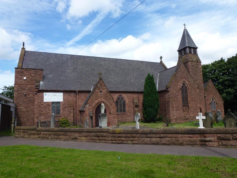
ELLESMERE PORT & NESTON STATION ROAD SJ 47 NW (west side) 3/60 - Christ Church - II 1869-71. Ellesmere Port Parish Church near site of earlier Chapel of Ease of Eastham Parish (demolished). Cruciform design, apparently on a limited budget, well composed with intersecting roofs of nave, chancel, short transepts and vestry. Small diminishing pyramidal spire with louvred belfry. Square rock- faced sandstone rubble walls. 3 light east window with geometric tracery; 3- light windows to spacious 4 bay aisleless nave, and 2-light to transepts, with plate tracery. INTERIOR: Interior largely unaltered. Collar braced cusped arched softwood trusses to nave roof; more massive trusses to chancel. Flat pointed arches between nave and 1 bay transepts. Stone pulpit with cusped arches and marble columns; circular stone font.
Listing NGR: SJ4042676946
External links are from the relevant listing authority and, where applicable, Wikidata. Wikidata IDs may be related buildings as well as this specific building. If you want to add or update a link, you will need to do so by editing the Wikidata entry.


Other nearby listed buildings