Approximate Location Map
Large Map »
Latitude: 50.6234 / 50°37'24"N
Longitude: -4.6778 / 4°40'40"W
OS Eastings: 210684
OS Northings: 83834
OS Grid: SX106838
Mapcode National: GBR N4.B482
Mapcode Global: FRA 172F.CDF
Plus Code: 9C2QJ8FC+9V
Entry Name: Gate Piers Adjoining to West of No 3 Manor Farm
Listing Date: 13 January 1988
Grade: II
Source: Historic England
Source ID: 1143563
English Heritage Legacy ID: 68539
ID on this website: 101143563
Location: Camelford, Cornwall, PL32
County: Cornwall
Civil Parish: Camelford
Built-Up Area: Camelford
Traditional County: Cornwall
Lieutenancy Area (Ceremonial County): Cornwall
Church of England Parish: Lanteglos by Camelford
Church of England Diocese: Truro
Tagged with: Gatepost
CAMELFORD VICTORIA ROAD, Camelford
SX 1083 -1183
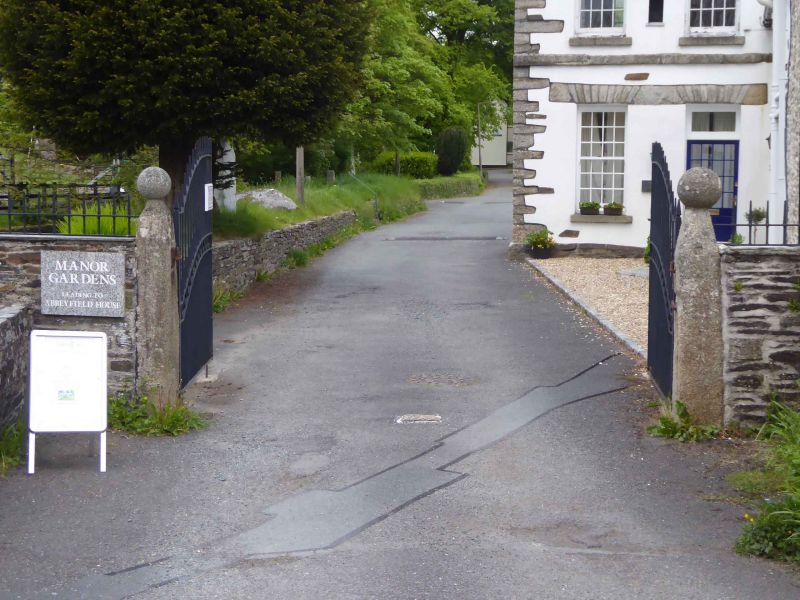
8/94 Gate piers adjoining to west of No.
- 3 Manor Farm
GV II
Pair of gate piers. Possibly C17. Granite. Small granite monoliths, square-on-plan
with tapered tops and surmounted by ball-finials.
Listing NGR: SX1068483834
External links are from the relevant listing authority and, where applicable, Wikidata. Wikidata IDs may be related buildings as well as this specific building. If you want to add or update a link, you will need to do so by editing the Wikidata entry.


Other nearby listed buildings
