Approximate Location Map
Large Map »
Latitude: 51.4539 / 51°27'14"N
Longitude: -0.9729 / 0°58'22"W
OS Eastings: 471466
OS Northings: 173271
OS Grid: SU714732
Mapcode National: GBR QLG.K7
Mapcode Global: VHDWT.3Q19
Plus Code: 9C3XF23G+HV
Entry Name: 9 Gun Street
Listing Date: 14 December 1978
Last Amended: 12 January 2024
Grade: II
Source: Historic England
Source ID: 1155899
English Heritage Legacy ID: 38966
Also known as: 9, Gun Street, Reading
9, Gun Street
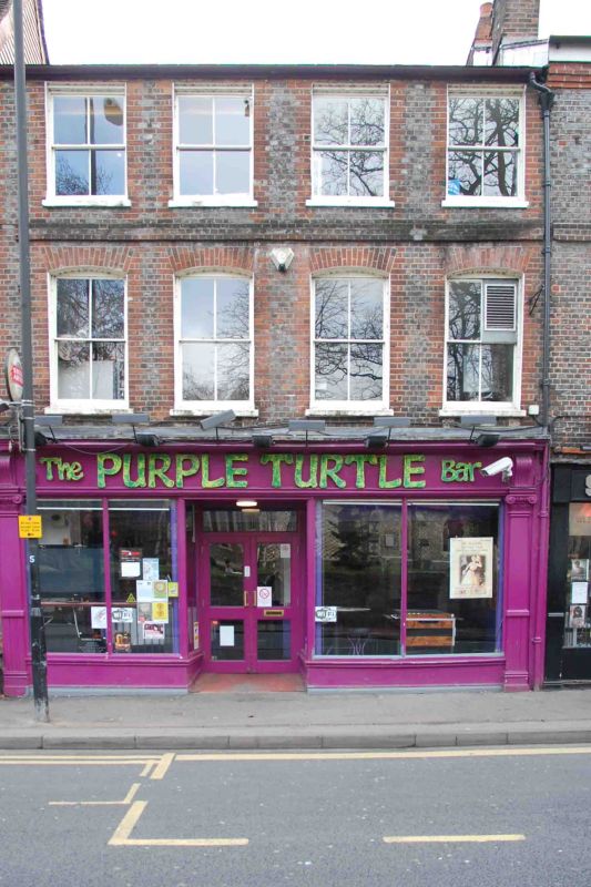
Purple Turtle, Reading
ID on this website: 101155899
Location: Reading, Berkshire, RG1
County: Reading
Electoral Ward/Division: Abbey
Parish: Non Civil Parish
Built-Up Area: Reading
Traditional County: Berkshire
Lieutenancy Area (Ceremonial County): Berkshire
Church of England Parish: Reading St Mary the Virgin
Church of England Diocese: Oxford
GUN STREET
1.
5128
No 9
SU 7173 SW 2/133
II GV
2.
Probably late C18. 3 storeys. Silver grey brick headers, red dressings, string
at 2nd floor. Roman tile roof. 4 ranges of plain sash windows. Ground floor
shop front: outer Ionic pilasters with Ionic caps and brackets to fascia, central
entrance. Interior: a dividing wall on 1st floor timber framed.
Listing NGR: SU7146373273
External links are from the relevant listing authority and, where applicable, Wikidata. Wikidata IDs may be related buildings as well as this specific building. If you want to add or update a link, you will need to do so by editing the Wikidata entry.


Other nearby listed buildings
