Approximate Location Map
Large Map »
Latitude: 51.4541 / 51°27'14"N
Longitude: -0.9727 / 0°58'21"W
OS Eastings: 471475
OS Northings: 173286
OS Grid: SU714732
Mapcode National: GBR QLG.L6
Mapcode Global: VHDWT.3Q35
Plus Code: 9C3XF23G+JW
Entry Name: 11 and 12 Gun Street
Listing Date: 14 December 1978
Last Amended: 25 January 2024
Grade: II
Source: Historic England
Source ID: 1303142
English Heritage Legacy ID: 38968
ID on this website: 101303142
Location: Reading, Berkshire, RG1
County: Reading
Electoral Ward/Division: Abbey
Parish: Non Civil Parish
Built-Up Area: Reading
Traditional County: Berkshire
Lieutenancy Area (Ceremonial County): Berkshire
Church of England Parish: Reading St Mary the Virgin
Church of England Diocese: Oxford
Tagged with: Building
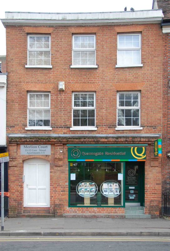
GUN STREET
1.
5128
Nos 11 and 12
SU 7173 SW 2/495
II GV
2.
Early C19. 3 storeys with cornice and blocking course. Red brick. 3 ranges
of glazing-bar sashes. Modern ground floor shop fronts.
Listing NGR: SU7147573286
External links are from the relevant listing authority and, where applicable, Wikidata. Wikidata IDs may be related buildings as well as this specific building. If you want to add or update a link, you will need to do so by editing the Wikidata entry.


Other nearby listed buildings
