Latitude: 51.452 / 51°27'7"N
Longitude: -0.1652 / 0°9'54"W
OS Eastings: 527584
OS Northings: 174151
OS Grid: TQ275741
Mapcode National: GBR D7.C0C
Mapcode Global: VHGR5.3R0S
Plus Code: 9C3XFR2M+QW
Entry Name: 26, Bolingbroke Grove
Listing Date: 7 April 1983
Grade: II
Source: Historic England
Source ID: 1183521
English Heritage Legacy ID: 206995
ID on this website: 101183521
Location: Wandsworth Common, Wandsworth, London, SW11
County: London
District: Wandsworth
Electoral Ward/Division: Northcote
Parish: Non Civil Parish
Built-Up Area: Wandsworth
Traditional County: Surrey
Lieutenancy Area (Ceremonial County): Greater London
Church of England Parish: Battersea St Luke
Church of England Diocese: Southwark
Tagged with: Building
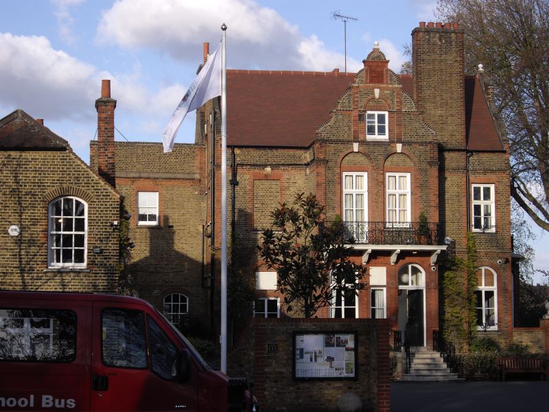
BOLINGBROKE GROVE 1. 5033 No 26 TQ 27SE 4/99 II 2. Said to have been built in 1876 by E R Robson. Detached house of 2 main storeys plus basement and garret. Picturesque design executed in stock brick with red dressings and tiled roof. Variously arched windows; ornamental ironwork to steps and first floor balcony; shaped gables. Extensive rear additions and outbuildings of no interest.
Listing NGR: TQ2758474151
External links are from the relevant listing authority and, where applicable, Wikidata. Wikidata IDs may be related buildings as well as this specific building. If you want to add or update a link, you will need to do so by editing the Wikidata entry.


Other nearby listed buildings