Latitude: 51.7754 / 51°46'31"N
Longitude: -1.2743 / 1°16'27"W
OS Eastings: 450165
OS Northings: 208770
OS Grid: SP501087
Mapcode National: GBR 7XD.NN4
Mapcode Global: VHCXM.VMPW
Plus Code: 9C3WQPGG+47
Entry Name: Oxford Canal Bridge Number 238
Listing Date: 28 June 1972
Grade: II
Source: Historic England
Source ID: 1184772
English Heritage Legacy ID: 245275
ID on this website: 101184772
Location: Summertown, Oxford, Oxfordshire, OX2
County: Oxfordshire
District: Oxford
Electoral Ward/Division: Summertown
Parish: Non Civil Parish
Traditional County: Oxfordshire
Lieutenancy Area (Ceremonial County): Oxfordshire
Church of England Parish: Summertown St Michael and All Angels
Church of England Diocese: Oxford
Tagged with: Bridge
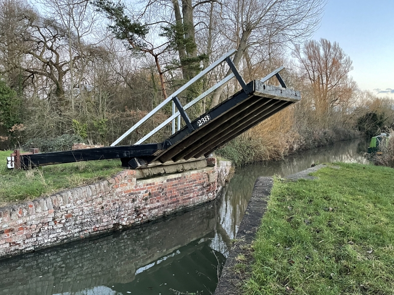
OXFORD CANAL 1. 1485 Bridge No 238 SP 50 NW 24/790 II 2. Designed by James Brindley. Built circa 1790. Counterweighted wooden drawbridge. Repaired 1967 (dated). Red brick retaining walls on either bank of canal.
Listing NGR: SP5016508769
External links are from the relevant listing authority and, where applicable, Wikidata. Wikidata IDs may be related buildings as well as this specific building. If you want to add or update a link, you will need to do so by editing the Wikidata entry.


Other nearby listed buildings