Approximate Location Map
Large Map »
Latitude: 53.3712 / 53°22'16"N
Longitude: -2.9992 / 2°59'57"W
OS Eastings: 333613
OS Northings: 386501
OS Grid: SJ336865
Mapcode National: GBR 7YHG.G7
Mapcode Global: WH87D.WJZF
Plus Code: 9C5V92C2+F8
Entry Name: 12 13, Rock Park
Listing Date: 13 March 1973
Grade: II
Source: Historic England
Source ID: 1201761
English Heritage Legacy ID: 389317
ID on this website: 101201761
Location: Rock Park, Wirral, Merseyside, CH42
County: Wirral
Electoral Ward/Division: Rock Ferry
Parish: Non Civil Parish
Built-Up Area: Birkenhead
Traditional County: Cheshire
Lieutenancy Area (Ceremonial County): Merseyside
Church of England Parish: Rock Ferry St Peter
Church of England Diocese: Chester
Tagged with: Building
BIRKENHEAD
SJ3386 ROCK PARK, Rock Ferry
789-1/12/257 (East side)
13/03/73 Nos.12 AND 13
GV II
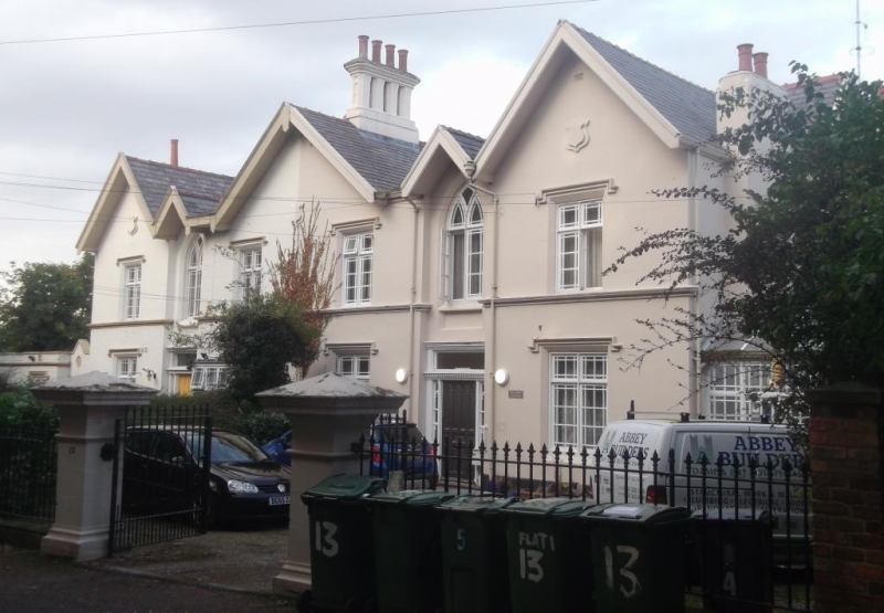
Pair of houses. c1836. Render with Welsh slate roof.
Picturesque gothic style with 2 storeys, and 3 wide gables
separated by narrower gables. Each house a double-pile, 3-unit
plan, the division between the houses running at the centre of
the central gable. Each house has central doorway in narrow
gable. Gothick panelled doors with overlights, traceried
side-lights and traceried window above. 2-light mullioned and
transomed windows with margin lights in the flanking gables,
blind windows in centre. Moulded sill band to first floor
windows, and slight hood moulds throughout. Advanced gable to
right retains ornamental bargeboards. Recessed further gable
to No.13 with late C20 full-height conservatory forming stair
hall in angle with main range. Axial and end wall stacks with
polygonal shafts and heavy caps. Elevation to Esplanade has a
similar configuration with 3 wide gables divided by narrower
ones. 2-storied bay window with trefoiled parapet in outer
bays, and tripartite gothick arched windows above. Fretted
wood-work canopy, part now missing across central gable. The
houses form part of the original Rock Park development laid
out in 1836 by J.Bennison.
(The Buildings of England: Pevsner N and Hubbard E: Cheshire:
Harmondsworth: 1971-).
Listing NGR: SJ3361386501
External links are from the relevant listing authority and, where applicable, Wikidata. Wikidata IDs may be related buildings as well as this specific building. If you want to add or update a link, you will need to do so by editing the Wikidata entry.


Other nearby listed buildings
