Latitude: 51.4557 / 51°27'20"N
Longitude: -2.6209 / 2°37'15"W
OS Eastings: 356953
OS Northings: 173148
OS Grid: ST569731
Mapcode National: GBR C2K.81
Mapcode Global: VH88M.JN8Y
Plus Code: 9C3VF94H+7J
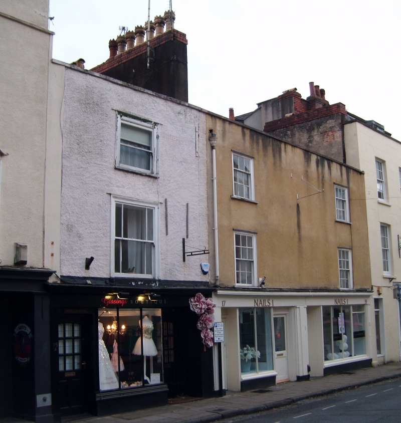
Entry Name: 15, 17 and 19, Portland Street
Listing Date: 30 December 1994
Grade: II
Source: Historic England
Source ID: 1202447
English Heritage Legacy ID: 380195
ID on this website: 101202447
Location: Clifton Wood, Bristol, BS8
County: City of Bristol
Electoral Ward/Division: Clifton
Parish: Non Civil Parish
Built-Up Area: Bristol
Traditional County: Gloucestershire
Lieutenancy Area (Ceremonial County): Bristol
Church of England Parish: Clifton Christ Church with Emmanuel
Church of England Diocese: Bristol
Tagged with: Building
BRISTOL
ST5673SE PORTLAND STREET, Clifton 901-1/7/925 (South side) Nos.15, 17 AND 19
GV II
Terrace of 3 houses. Mid C18 with possible earlier origins. Roughcast, brick party wall stack and pantile roof. Double-depth plan. Each of 3 storeys with attic; 1-window range. Shopfronts to Nos 17 & 19 have left-hand doors to flats above, mid/late C19 plate-glass windows with thin mullions and a glazed door to No.17, and a continuous cornice; No.15 similar with a right-hand doorway. Nos 17 & 19 have 6/6-pane first-floor and 3/6-pane second-floor sashes in flush frames, No.15 has horned 3/3-pane margin-glazed sashes in flush frames; thin raking dormer to No.17. Large stack between Nos 15 & 17. INTERIOR: largely remodelled c1970. Reported as having timber cruck-like blades in the rear wall, exposed during renovation.
Listing NGR: ST5695373148
External links are from the relevant listing authority and, where applicable, Wikidata. Wikidata IDs may be related buildings as well as this specific building. If you want to add or update a link, you will need to do so by editing the Wikidata entry.


Other nearby listed buildings