Approximate Location Map
Large Map »
Latitude: 51.0684 / 51°4'6"N
Longitude: 0.6873 / 0°41'14"E
OS Eastings: 588376
OS Northings: 133332
OS Grid: TQ883333
Mapcode National: GBR QW3.SPL
Mapcode Global: FRA D6B9.7LC
Plus Code: 9F323M9P+9W
Entry Name: 40, High Street
Listing Date: 8 June 1972
Grade: II
Source: Historic England
Source ID: 1203228
English Heritage Legacy ID: 179753
ID on this website: 101203228
Location: Tenterden, Ashford, Kent, TN30
County: Kent
District: Ashford
Civil Parish: Tenterden
Built-Up Area: Tenterden
Traditional County: Kent
Lieutenancy Area (Ceremonial County): Kent
Tagged with: Building
1.
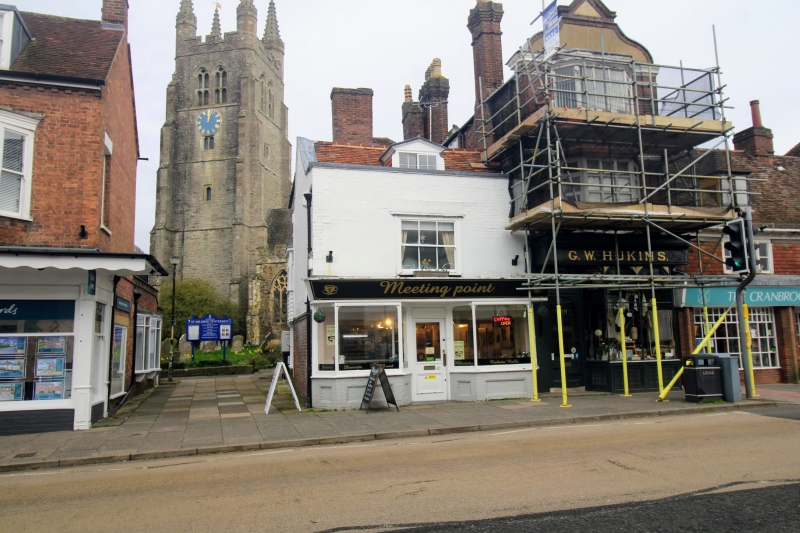
1715 HIGH STREET
(North Side)
No 40
TQ 8833 1/40
II GV
2.
C18. 2 storeys and attic. The front elevation is partly painted brick and
partly painted mathematical tiles, the sides and back have weatherboarding
above the ground floor. Tiles roof with parapet. One window and one dormer.
Small bay window on the 1st floor with glazing bars intact. Modern shop front.
All the listed buildings on the north side from Nos 10 to 44, including
Church of St Mildred, form a group.
Listing NGR: TQ8837433335
External links are from the relevant listing authority and, where applicable, Wikidata. Wikidata IDs may be related buildings as well as this specific building. If you want to add or update a link, you will need to do so by editing the Wikidata entry.


Other nearby listed buildings
