Approximate Location Map
Large Map »
Latitude: 51.0685 / 51°4'6"N
Longitude: 0.6874 / 0°41'14"E
OS Eastings: 588386
OS Northings: 133339
OS Grid: TQ883333
Mapcode National: GBR QW3.SS5
Mapcode Global: FRA D6B9.7NK
Plus Code: 9F323M9P+9X
Entry Name: 34 and 36, High Street
Listing Date: 8 June 1972
Grade: II
Source: Historic England
Source ID: 1070345
English Heritage Legacy ID: 179752
ID on this website: 101070345
Location: Tenterden, Ashford, Kent, TN30
County: Kent
District: Ashford
Civil Parish: Tenterden
Built-Up Area: Tenterden
Traditional County: Kent
Lieutenancy Area (Ceremonial County): Kent
Tagged with: Building
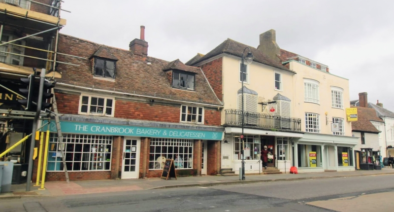
1.
1715 HIGH STREET
(North Side)
Nos 34 & 36
TQ 8833 1/39
II GV
2.
C18 pair. 2 storeys and attics. Timber-framed. Ground floor faced with red
brick and 1st floor tile-hung. 2 hipped dormers. Eaves cornice. 2 windows.
Modern shop fronts.
All the listed buildings on the north side from Nos 10 to 44, including
Church of St Mildred, form a group.
Listing NGR: TQ8838433342
External links are from the relevant listing authority and, where applicable, Wikidata. Wikidata IDs may be related buildings as well as this specific building. If you want to add or update a link, you will need to do so by editing the Wikidata entry.


Other nearby listed buildings
