Approximate Location Map
Large Map »
Latitude: 52.3376 / 52°20'15"N
Longitude: -2.2768 / 2°16'36"W
OS Eastings: 381234
OS Northings: 271092
OS Grid: SO812710
Mapcode National: GBR 0C0.F5P
Mapcode Global: VH920.HH5V
Plus Code: 9C4V8PQF+27
Entry Name: 18, Lichfield Street
Listing Date: 11 October 1991
Grade: II
Source: Historic England
Source ID: 1209460
English Heritage Legacy ID: 393353
ID on this website: 101209460
Location: Stourport-on-Severn, Wyre Forest, Worcestershire, DY13
County: Worcestershire
District: Wyre Forest
Civil Parish: Stourport-on-Severn
Built-Up Area: Stourport-on-Severn
Traditional County: Worcestershire
Lieutenancy Area (Ceremonial County): Worcestershire
Church of England Parish: Stourport-on-Severn and Wilden
Church of England Diocese: Worcester
Tagged with: Building
STOURPORT ON SEVERN
SO8171SW LICHFIELD STREET
589-1/9/46 (South side)
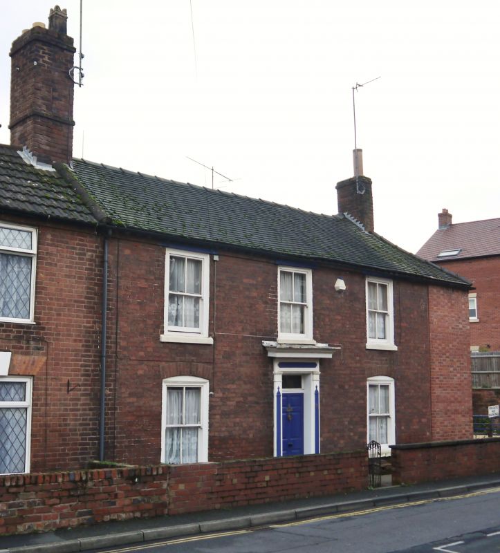
No.18
GV II
House. Largely c1800, but refronted circa 1850. Brick with
tiled roof. 2-storeyed, 3 bays with central 6-panelled door
with overlight in moulded architrave and entablature, flanked
by 4-paned sash windows with segmentally arched brick heads.
Narrow additional bay to right encased recently in new brick.
Interior survives substantially from c1800, with staircase
with moulded open string. Gable end stacks.
Listing NGR: SO8123471092
External links are from the relevant listing authority and, where applicable, Wikidata. Wikidata IDs may be related buildings as well as this specific building. If you want to add or update a link, you will need to do so by editing the Wikidata entry.


Other nearby listed buildings
