Approximate Location Map
Large Map »
Latitude: 52.3399 / 52°20'23"N
Longitude: -2.2745 / 2°16'28"W
OS Eastings: 381392
OS Northings: 271347
OS Grid: SO813713
Mapcode National: GBR 0C0.7RH
Mapcode Global: VH920.JGD3
Plus Code: 9C4V8PQG+X5
Entry Name: 41, Mitton Street
Listing Date: 5 July 1950
Grade: II
Source: Historic England
Source ID: 1209468
English Heritage Legacy ID: 393365
ID on this website: 101209468
Location: Stourport-on-Severn, Wyre Forest, Worcestershire, DY13
County: Worcestershire
District: Wyre Forest
Civil Parish: Stourport-on-Severn
Built-Up Area: Stourport-on-Severn
Traditional County: Worcestershire
Lieutenancy Area (Ceremonial County): Worcestershire
Church of England Parish: Stourport-on-Severn and Wilden
Church of England Diocese: Worcester
Tagged with: Building
STOURPORT ON SEVERN
SO8171SW MITTON STREET
589-1/9/56 (North side)
05/07/50 No.41
II
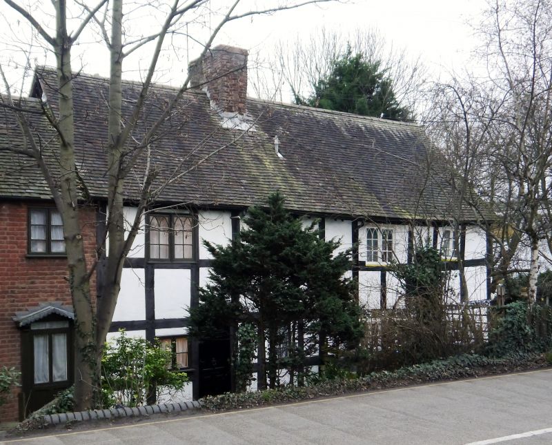
House. Probably early C17. Timber-framed with plain tiled
roof. 2-storeyed, framed in square panels, 4 high, 12 in
length. Axial stack, with fragments of original diagonal brick
flues, and doorway to left of it. 3 small casement windows
contained within the panels, 2 upper windows having traceried
glazing. Queen post and strut roof construction visible in
gable wall.
Listing NGR: SO8139271347
External links are from the relevant listing authority and, where applicable, Wikidata. Wikidata IDs may be related buildings as well as this specific building. If you want to add or update a link, you will need to do so by editing the Wikidata entry.


Other nearby listed buildings
