Approximate Location Map
Large Map »
Latitude: 52.3411 / 52°20'27"N
Longitude: -2.2734 / 2°16'24"W
OS Eastings: 381470
OS Northings: 271481
OS Grid: SO814714
Mapcode National: GBR 0C0.814
Mapcode Global: VH920.KF05
Plus Code: 9C4V8PRG+CJ
Entry Name: The Steps House Public House
Listing Date: 28 February 1975
Last Amended: 11 October 1991
Grade: II
Source: Historic England
Source ID: 1210091
English Heritage Legacy ID: 393331
ID on this website: 101210091
Location: Stourport-on-Severn, Wyre Forest, Worcestershire, DY13
County: Worcestershire
District: Wyre Forest
Civil Parish: Stourport-on-Severn
Built-Up Area: Stourport-on-Severn
Traditional County: Worcestershire
Lieutenancy Area (Ceremonial County): Worcestershire
Church of England Parish: Stourport-on-Severn and Wilden
Church of England Diocese: Worcester
Tagged with: Pub
STOURPORT ON SEVERN
SO8171SW GILGAL
589-1/9/24 (West side)
28/02/75 No.18
The Steps House Public House
(Formerly Listed as:
GILGAL
No.18
(Formerly the Red Lion Public House))
GV II
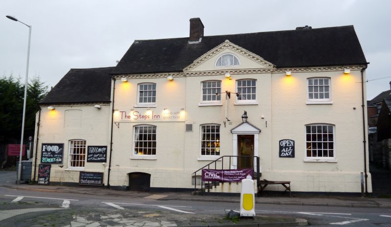
Public house, originally dwelling. Late C18, re-fronted c1820.
Painted brick with plain tiled roof. 2-storeyed, 4 bays with
projecting pedimented central section of 2 bays. Doorway with
pedimented case with fluted shafts to right of this central
section. 16-pane sash and paired 12-pane sashes above, all
with segmentally arched brick heads. Semi- circular window
beneath pediment. Wide lower windows in outer bays - 20-pane
sashes. Lower, later addition of one bay to south with single
sash window. Two axial stacks. Included for group value.
Listing NGR: SO8147071481
External links are from the relevant listing authority and, where applicable, Wikidata. Wikidata IDs may be related buildings as well as this specific building. If you want to add or update a link, you will need to do so by editing the Wikidata entry.


Other nearby listed buildings
