Approximate Location Map
Large Map »
Latitude: 52.3414 / 52°20'29"N
Longitude: -2.2731 / 2°16'23"W
OS Eastings: 381492
OS Northings: 271515
OS Grid: SO814715
Mapcode National: GBR 0C0.25F
Mapcode Global: VH920.KD5X
Plus Code: 9C4V8PRG+HQ
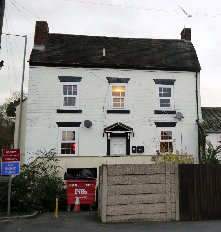
Entry Name: 15, Gilgal
Listing Date: 23 July 1979
Grade: II
Source: Historic England
Source ID: 1210089
English Heritage Legacy ID: 393329
ID on this website: 101210089
Location: Stourport-on-Severn, Wyre Forest, Worcestershire, DY13
County: Worcestershire
District: Wyre Forest
Civil Parish: Stourport-on-Severn
Built-Up Area: Stourport-on-Severn
Traditional County: Worcestershire
Lieutenancy Area (Ceremonial County): Worcestershire
Church of England Parish: Stourport-on-Severn and Wilden
Church of England Diocese: Worcester
Tagged with: Building
STOURPORT ON SEVERN
SO8171NW GILGAL
589-1/5/22 (East side)
23/07/79 No.15
GV II
House. c1800. Brick with plain tiled gambrel roof. 2-storeyed,
3 bays raised on a projecting basement. Central 6-panelled
door in case with console brackets to pedimented head. 12-pane
sashes with stuccoed flat-arched heads. Moulded brick
dentilled eaves cornice, gable end stacks.
Listing NGR: SO8149271515
External links are from the relevant listing authority and, where applicable, Wikidata. Wikidata IDs may be related buildings as well as this specific building. If you want to add or update a link, you will need to do so by editing the Wikidata entry.


Other nearby listed buildings
