Approximate Location Map
Large Map »
Latitude: 51.396 / 51°23'45"N
Longitude: -1.3249 / 1°19'29"W
OS Eastings: 447063
OS Northings: 166547
OS Grid: SU470665
Mapcode National: GBR 81Z.FVH
Mapcode Global: VHCZJ.Z5FN
Plus Code: 9C3W9MWG+C2
Entry Name: 6-13, Madeira Place
Listing Date: 2 September 1983
Grade: II
Source: Historic England
Source ID: 1210274
English Heritage Legacy ID: 394799
ID on this website: 101210274
Location: City, West Berkshire, RG14
County: West Berkshire
Civil Parish: Newbury
Built-Up Area: Newbury
Traditional County: Berkshire
Lieutenancy Area (Ceremonial County): Berkshire
Church of England Parish: Newbury St John the Evangelist
Church of England Diocese: Oxford
Tagged with: Building
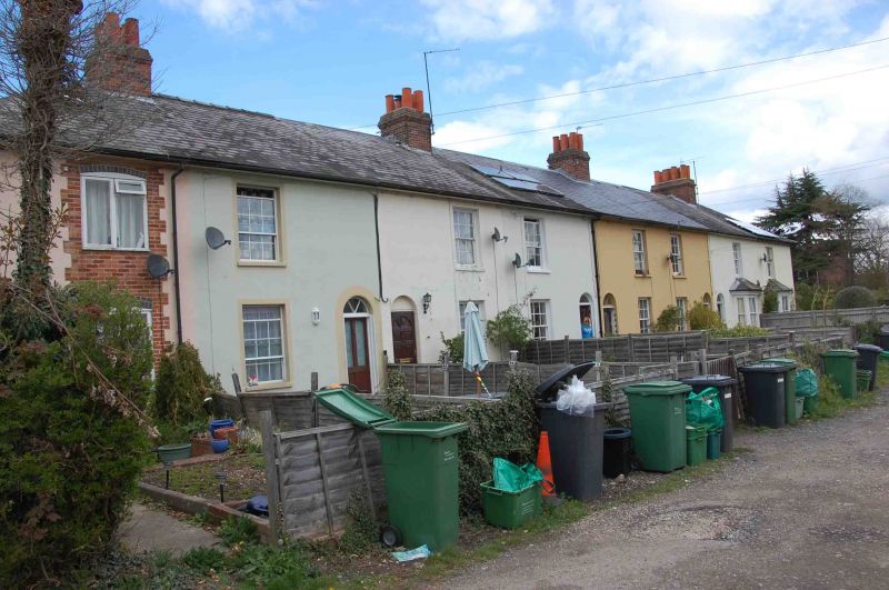
1. MADEIRA PLACE
5127
Nos 6 to 13 (consec)
SU 4766 NW 8/111
II GV
2.
Mid C19 (before 1849) terrace. Two storeys. One window each. Hipped slate
roofs with moulded ridge stacks. Rendered brick. Recessed sash windows with glazing bars. Round-arched doorways with radial fanlights and 1/2 glazed
doors.
Listing NGR: SU4706366547
External links are from the relevant listing authority and, where applicable, Wikidata. Wikidata IDs may be related buildings as well as this specific building. If you want to add or update a link, you will need to do so by editing the Wikidata entry.


Other nearby listed buildings
