Approximate Location Map
Large Map »
Latitude: 51.2849 / 51°17'5"N
Longitude: 1.0698 / 1°4'11"E
OS Eastings: 614161
OS Northings: 158450
OS Grid: TR141584
Mapcode National: GBR TY2.79T
Mapcode Global: VHLGF.HYDW
Plus Code: 9F3373M9+XW
Entry Name: Holly Tree Cottage
Listing Date: 7 September 1973
Grade: II
Source: Historic England
Source ID: 1242880
English Heritage Legacy ID: 443896
ID on this website: 101242880
Location: St Dunstan's, Canterbury, Kent, CT2
County: Kent
District: Canterbury
Electoral Ward/Division: St Stephen's
Parish: Non Civil Parish
Built-Up Area: Canterbury
Traditional County: Kent
Lieutenancy Area (Ceremonial County): Kent
Tagged with: Cottage
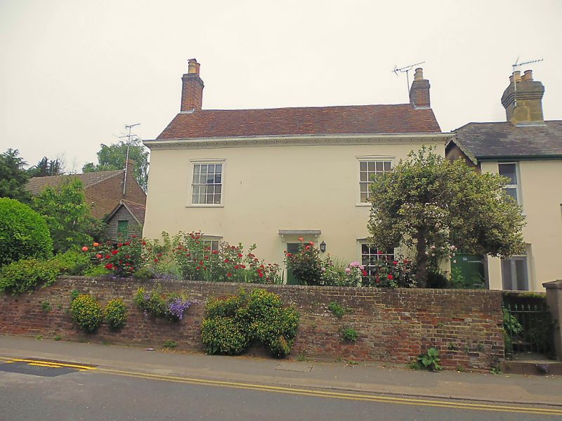
1.
944 WHITSTABLE ROAD
(East Side)
No 34
(Holly Tree Cottage)
TR 1458 SW 1/137
II
2.
Late C18 or early C19. 2 parallel ranges. 2 storeys stuccoed. Old tiled
roof with wooden bracket cornice. 2 sashes with wooden architraves having
glazing bars intact. Central doorcase has vestigial weatherhood, brackets,
fluted pilasters and 6 Panelled door with some glazed panels. The side elevation
has traces of windows built out.
Listing NGR: TR1416458451
External links are from the relevant listing authority and, where applicable, Wikidata. Wikidata IDs may be related buildings as well as this specific building. If you want to add or update a link, you will need to do so by editing the Wikidata entry.


Other nearby listed buildings
