Approximate Location Map
Large Map »
Latitude: 53.3977 / 53°23'51"N
Longitude: -1.4868 / 1°29'12"W
OS Eastings: 434224
OS Northings: 389109
OS Grid: SK342891
Mapcode National: GBR 9CC.RT
Mapcode Global: WHDDH.4V9M
Plus Code: 9C5W9GX7+37
Entry Name: Sandbed Weir
Listing Date: 12 December 1995
Grade: II
Source: Historic England
Source ID: 1247282
English Heritage Legacy ID: 456632
ID on this website: 101247282
Location: Hillfoot, Sheffield, South Yorkshire, S6
County: Sheffield
Electoral Ward/Division: Hillsborough
Parish: Non Civil Parish
Built-Up Area: Sheffield
Traditional County: Yorkshire
Lieutenancy Area (Ceremonial County): South Yorkshire
Church of England Parish: Pitsmoor Christ Church
Church of England Diocese: Sheffield
Tagged with: Weir
SHEFFIELD
SK38NW CLUB MILL ROAD
784-1/5/206 (West side (off))
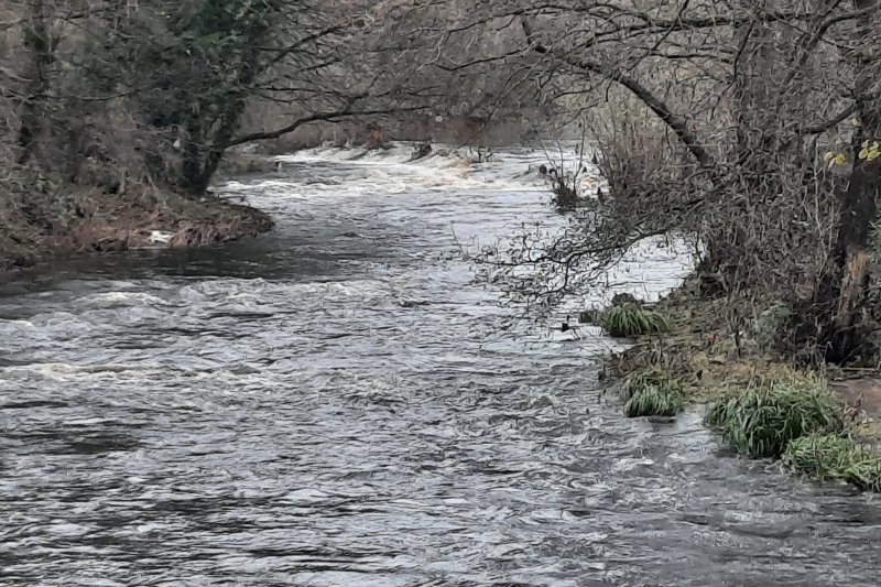
Sandbed Weir
II
Weir on River Don, formerly supplying the Clifton Steelworks
(not included). Mid C19. Straight weir, approx 100m long.
Coursed squared stone top sill, with coursed rubble downstream
side. Blocked outlet at south end.
Listing NGR: SK3422489109
External links are from the relevant listing authority and, where applicable, Wikidata. Wikidata IDs may be related buildings as well as this specific building. If you want to add or update a link, you will need to do so by editing the Wikidata entry.


Other nearby listed buildings
