Latitude: 52.2435 / 52°14'36"N
Longitude: 0.7147 / 0°42'52"E
OS Eastings: 585434
OS Northings: 264062
OS Grid: TL854640
Mapcode National: GBR QF0.7J1
Mapcode Global: VHKD4.BWN0
Plus Code: 9F426PV7+9V
Entry Name: 22, 23 and 24, Churchgate Street
Listing Date: 12 July 1972
Grade: II
Source: Historic England
Source ID: 1248117
English Heritage Legacy ID: 466706
ID on this website: 101248117
Location: Bury St Edmunds, West Suffolk, IP33
County: Suffolk
District: West Suffolk
Civil Parish: Bury St Edmunds
Built-Up Area: Bury St Edmunds
Traditional County: Suffolk
Lieutenancy Area (Ceremonial County): Suffolk
Church of England Parish: Bury St Edmunds St Mary
Church of England Diocese: St.Edmundsbury and Ipswich
Tagged with: Building
BURY ST EDMUNDS
TL8564SW CHURCHGATE STREET 639-1/14/239 (North side) 12/07/72 Nos.22, 23 AND 24
GV II
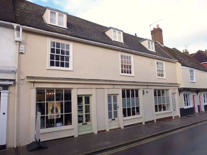
A pair of shops, formerly 3, with living accommodation above. Late C17/early C18, altered in the early C19; late C20 refurbishing. Timber-framed and rendered; plaintiled roof with wide plain eaves soffit. EXTERIOR: 2 storeys and attics; cellar below No.24; a 2-storey red brick lean-to extension along the rear. A chimney-stack at the west end, with a large rectangular red brick shaft surmounted by 6 chimney-pots, is shared with the adjacent building (No.21 qv). 3 window range: 16-pane sashes in heavy cased frames which project slightly. 3 shop fronts with fixed 12-pane windows, panelled bases and plain pilasters below a continuous fascia with a moulded cornice. 3 C20 half-glazed doors. 3 flat-headed dormers have 2-light casement windows with a single vertical bar to lights. Attached to the upper front is part of an old street lamp. The rear extension has mixed fenestration, including one small-paned sash window and one small-paned sliding sash. INTERIOR with remains of poor timbering, including some softwood. The partition wall between Nos 23 and 24 has been removed, and also the original rear wall. The upper storeys are said to have no timbering exposed.
Listing NGR: TL8543464062
External links are from the relevant listing authority and, where applicable, Wikidata. Wikidata IDs may be related buildings as well as this specific building. If you want to add or update a link, you will need to do so by editing the Wikidata entry.


Other nearby listed buildings