Approximate Location Map
Large Map »
Latitude: 53.7949 / 53°47'41"N
Longitude: -1.5391 / 1°32'20"W
OS Eastings: 430457
OS Northings: 433272
OS Grid: SE304332
Mapcode National: GBR BKM.YF
Mapcode Global: WHC9D.BWB4
Plus Code: 9C5WQFV6+W9
Entry Name: 32 and 34, the Calls
Listing Date: 8 May 1974
Grade: II
Source: Historic England
Source ID: 1255927
English Heritage Legacy ID: 465456
ID on this website: 101255927
Location: Steander, Leeds, West Yorkshire, LS2
County: Leeds
Electoral Ward/Division: City and Hunslet
Parish: Non Civil Parish
Built-Up Area: Leeds
Traditional County: Yorkshire
Lieutenancy Area (Ceremonial County): West Yorkshire
Church of England Parish: Leeds City
Church of England Diocese: Leeds
Tagged with: Building
LEEDS
SE3033SW THE CALLS
714-1/78/381 (South side)
08/05/74 Nos.32 AND 34
II
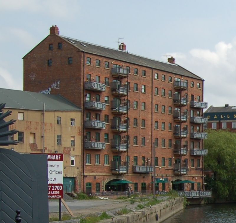
Mill and warehouse, now flats, offices and public house. Early
C19, converted 1994-5. Red brick, rendered on east gable,
slate roof, gable copings, short stack to both ends and
centre, forward of ridge, hoist above eaves.
6 storeys to The Calls, 7 to river side; 14 first-floor
openings arranged symmetrically on each side of a centre line:
a tier of loading doors flanked by 3 small segmental-arched
windows; this arrangement is clear on both sides of the
building.
The Calls: loading doors with C20 frames and grilles, C20
ground-floor openings and window frames, the ground floor
cement rendered with rusticated ashlar finish. River facade:
basement entrances with wide segmental arches, stone voussoirs
and keystone, flanked by narrow doors and windows; stone
projecting band at ground floor level. Stone window sills,
some cast-iron small-pane frames survive; stone loading
platforms right, supported on brackets similar to those at
Simpson's Fold warehouse, Dock St (qv).
INTERIOR: the break in the window pattern expresses a
structural wall, dividing the building into 2 properties from
the beginning.
Stands on an important site close to the SE corner of the
Cloth Hall and on the river edge, straddling the narrow goit
which joins the river at this point.
Listing NGR: SE3045733272
External links are from the relevant listing authority and, where applicable, Wikidata. Wikidata IDs may be related buildings as well as this specific building. If you want to add or update a link, you will need to do so by editing the Wikidata entry.


Other nearby listed buildings
